Satellite images of Nova Kakhovka Dam and flooding
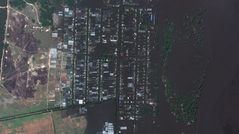
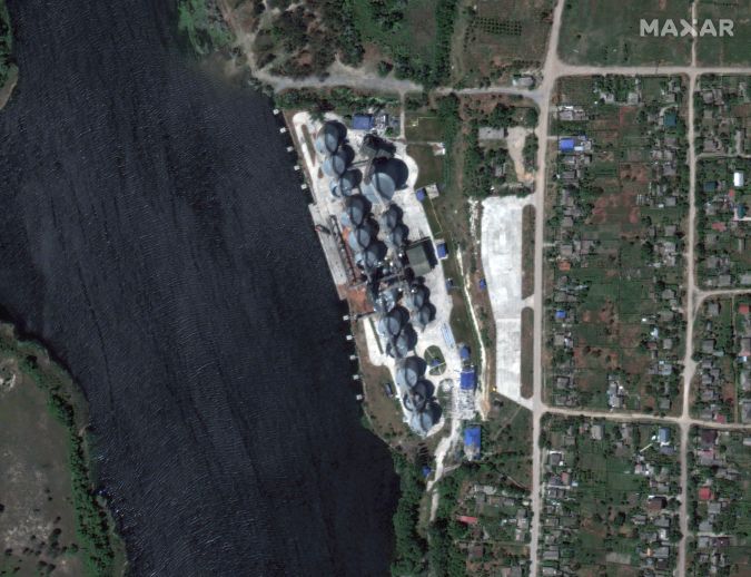
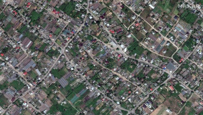
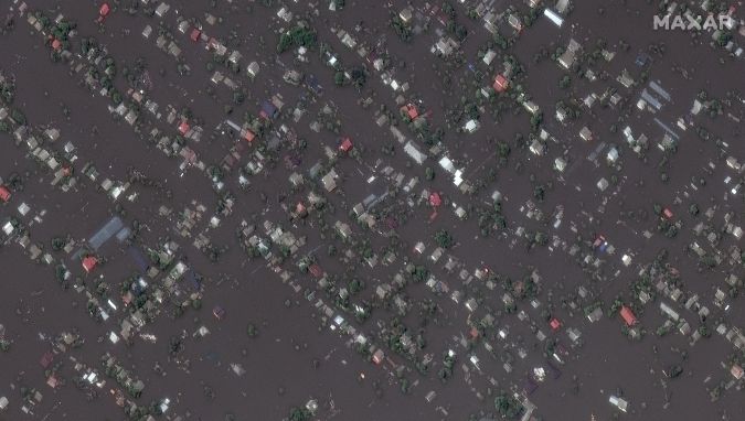
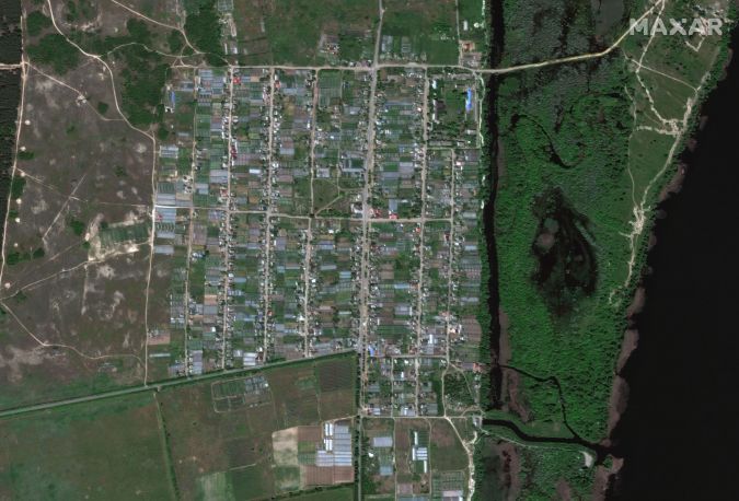
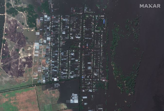
European Space Imaging (EUSI) partner, Maxar collected new high-resolution satellite imagery on 7 June amidst the aftermath of the collapse of the Nova Kakhovka Dam and the widespread flooding along villages and towns downstream from the dam.
In addition to the largely destroyed dam, hundreds of homes, buildings and infrastructure along the Dnipro River are submerged by the floodwaters. These images were collected by three different satellites in the WorldView Constellation with a Ground Sampling Distance (GSD) between 30 – 50 cm per pixel. Here you can download the original imagery.
|

|
|
|
|
|
EUSI is constantly monitoring emergency situations throughout Europe in order to deliver the most accurate data to first responders and the communities that require this information. Satellite imagery has proven invaluable over the past two decades for natural and manmade disaster response efforts, but has gained more exposure during the war in Ukraine as investigative journalists have increasingly used space-based remote sensing to analyze ecological and humanitarian events in the region.

Value staying current with geomatics?
Stay on the map with our expertly curated newsletters.
We provide educational insights, industry updates, and inspiring stories to help you learn, grow, and reach your full potential in your field. Don't miss out - subscribe today and ensure you're always informed, educated, and inspired.
Choose your newsletter(s)


