Scottish Cities Added to MetroVista 3D City Line-up
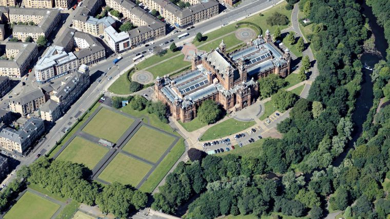
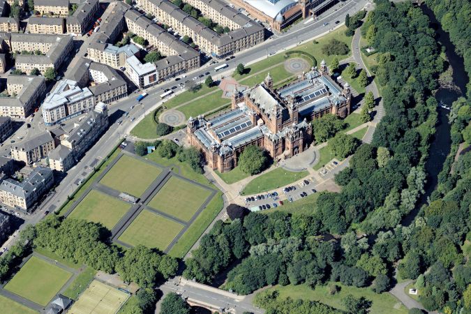
Aerial mapping company Bluesky International has added Edinburgh and Glasgow to its growing coverage of MetroVista 3D city models. Acquired using an advanced aerial sensor that simultaneously captures vertical and oblique imagery together with high point-density Lidar, MetroVista data is becoming increasingly popular for smart city applications.
Providing a geographically accurate and detailed 3D representation of the urban environment, MetroVista data has already provided insight for a range of applications including urban design, defence and security modelling, insurance assessments and utility and telecom planning.
Analysing the Impact of New Developments
“We are becoming progressively more urbanized, which places pressures on those charged with managing this environment and delivering services within it,” commented Ralph Coleman, director of sales at Bluesky International. “In order to make informed and joined-up decisions, it is essential to not only visualize how our cityscapes currently look but also to be able to measure, model and analyse the impact of new developments."
“Using MetroVista 3D models we can visualize the present and simulate the future, enabling analysis of the impact and engaging communication of the results, all with a high degree of confidence and without leaving the office.”
Hybrid Aerial Mapping
Bluesky captured the urban centres of Edinburgh and Glasgow in 2021 and the data is now available as ultra-high resolution 5cm aerial photography together with 16ppm Lidar. The data is also being processed to create a fully rendered mesh model suitable for use in a range of GIS, CAD and modelling software packages.
The Leica CityMapper sensor, used to capture MetroVista data, was among the world’s first hybrid airborne sensors. The first camera captures vertical, or nadir, true ortho aerial photography, in both RGB and near infrared, whilst the remaining four cameras provide complete 360-degree oblique coverage. Combined with data from the integrated high-density Lidar, this allows for the production, with minimal manual interaction, of accurate and detailed, citywide mesh models.
Standalone Datasets and Processed Data
Bluesky, known as the aerial mapping company in the UK with complete coverage of high-resolution imagery and height data of England, Wales, Scotland and the Republic of Ireland, was the first to exploit the power of this new technology in Europe. Launched to market as MetroVista the Bluesky data is available as standalone datasets (vertical/oblique/Lidar point clouds) or processed data (digital terrain or surface models [DTM/DSMs] or fully rendered 3D mesh models).
Since acquiring the first CityMapper in Europe, Bluesky has captured more than 1,500sqkm of MetroVista data to date, including of Birmingham, Brighton, Bristol, Cambridge, Leicester, London, Nottingham and Oxford, plus many more.

Value staying current with geomatics?
Stay on the map with our expertly curated newsletters.
We provide educational insights, industry updates, and inspiring stories to help you learn, grow, and reach your full potential in your field. Don't miss out - subscribe today and ensure you're always informed, educated, and inspired.
Choose your newsletter(s)


