SimActive used with Phase One cameras for precise photogrammetry
SimActive has announced the use of its Correlator3D product by Phase One camera users around the world. SimActive is a developer of high-end photogrammetry software, which is used to process imagery from the smallest sensor – the IXM-50 typically used with drones – to larger ones such as the PAS 880i NIR which includes oblique and nadir systems for citywide mapping.
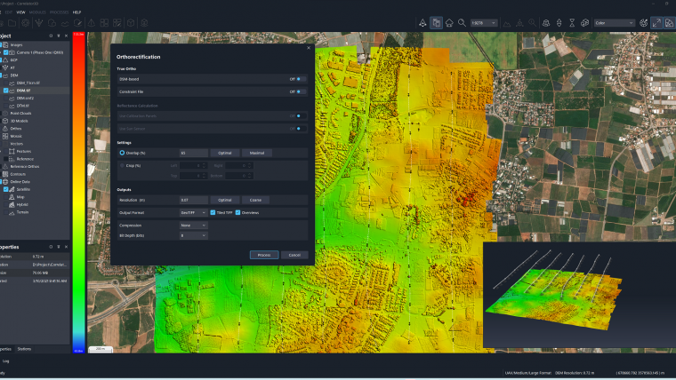
Correlator3D allows importing very large projects in the native Phase One IIQ format. This eliminates the need for conversion to TIF and reduces project setup time when working with thousands of images. Then, the processing workflow remains the same regardless of sensor size. Outputs including DSMs, DTMs, point clouds, orthomosaics and 3D meshes are all generated with the highest degree of precision.
“Being able to import our native IIQ format means SimActive software is making full use of our 16-bit data,” said Kevin Graville, system sales manager with Phase One. “Correlator3D’s ability to process very large datasets is right in line with our clients’ expectations.”
Phase One, established in 1993, pioneers digital imaging sensors and aerial systems. It is a leader in aerial cameras, known for reliable sensors and excellent image quality. Across sectors like aerial mapping, industrial inspection and heritage digitization, Phase One's technology excels. SimActive, developer of Correlator3D software, offers patented photogrammetry solutions. This software generates geospatial data from satellite, aerial and drone imagery. Correlator3D swiftly produces models, point clouds and orthomosaics, benefiting mapping firms and government bodies worldwide.


Value staying current with geomatics?
Stay on the map with our expertly curated newsletters.
We provide educational insights, industry updates, and inspiring stories to help you learn, grow, and reach your full potential in your field. Don't miss out - subscribe today and ensure you're always informed, educated, and inspired.
Choose your newsletter(s)


