Stonex unveils hybrid mobile real-time mapping solution
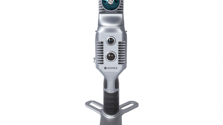
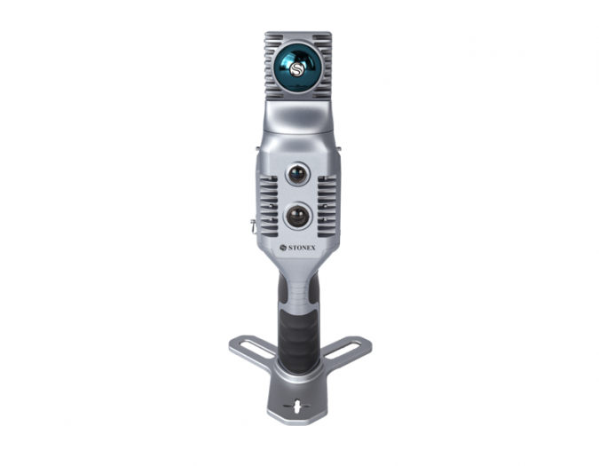
Stonex has launched a new SLAM solution for fast and efficient large-area surveys: the X70GO SLAM laser scanner. It combines mobile scanning with a stationary mode to scan with higher resolution, enhancing its overall surveying capabilities.
With the brand-new mapping solution, Stonex extends its array of reality-capturing instruments to a more diverse user base. X70GO is a real-time 3D model reconstruction device which integrates an inertial navigation module, high-performance computer and storage system. It is equipped with a 360° rotating head, which, combined with the SLAM algorithm, generates high-precision point cloud data. The built-in 512GB memory disk facilitates the storage of the survey results and the dismountable handle has a 1.5-hour battery life.
A 12MP RGB camera provides texture information, while a visual camera enhances the real-time preview with the GOapp. Mapping results are generated immediately inside the scanner, right after scanning. Users can choose to colour them and improve their accuracy during post-processing with GOpost software.
The system’s big innovation is the hybrid scanning capability. The X-Whizz mode combines the advantages of SLAM mode with the resolution of a static scan, eliminating the need for multiple scan stations. Users can just move around the scene to collect the entire 3D point cloud, without time-consuming cloud-to-cloud alignment.
Challenging and demanding environments
The technology incorporated in the new scanner encompasses extended range, a higher number of points per second, and advanced onboard processing algorithms. This combination achieves an unparalleled speed of capture and reliability, making the X70GO SLAM laser scanner particularly well-suited for use in challenging and demanding environments. It can be utilized across a wide range of applications, including BIM, industrial sites, real estate, heritage preservation, tunnels and mining, to name but a few.
An additional option is the possibility of adding an RTK module to set a point cloud in a global coordinate system. This can support the addition of GNSS information to Lidar and IMU in the SLAM algorithm. Moreover, in situations with limited GPS connectivity – such as indoors or challenging environments – the system will rely on Lidar and IMU for positioning purposes.
For more information, watch this video.

Value staying current with geomatics?
Stay on the map with our expertly curated newsletters.
We provide educational insights, industry updates, and inspiring stories to help you learn, grow, and reach your full potential in your field. Don't miss out - subscribe today and ensure you're always informed, educated, and inspired.
Choose your newsletter(s)


