Texas Renews Major Geodata Contract with Fugro
Fugro has been awarded its second consecutive geodata solutions contract by the Texas Department of Information Resources (DIR) to support the US state’s Strategic Mapping Program (StratMap). The new contract will run for up to five years, providing opportunities for the state and its local government, public utility and academia partners to contract with Fugro for comprehensive GIS, geospatial and geotechnical offerings.
Projects completed under the StratMap contract will help DIR meet its goal of developing consistent digital geodata layers across the state for more efficient and effective governance.
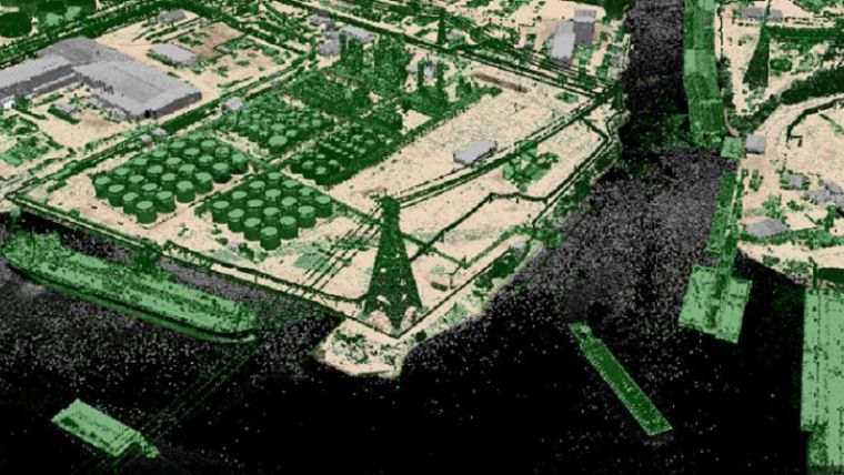
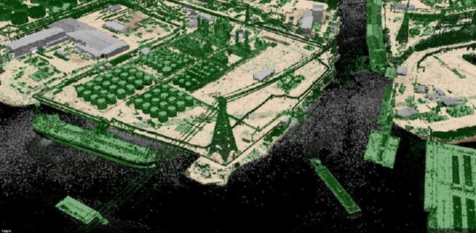
Lidar and photogrammetry-based coastal mapping
The award builds on Fugro’s decades-long experience of providing Lidar and imagery mapping services across Texas, including for post-hurricane flood assessment. Two unique capabilities available under the new contract include Fugro RAMMS, a fast and efficient coastal mapping solution, and Fugro SIMmetry, a GIS-based 3D visualization and data management system. Together, these innovative technologies provide powerful geodata tools to help users maintain critical infrastructure and services, protect the environment and safeguard lives during major storm events. The contract also provides DIR and its partners access to Fugro’s full range of aerial mapping, road condition surveying and site investigation services, as well as to existing geodata libraries and geodata conversion and management offerings.
“We are pleased to continue our partnership with DIR on another StratMap contract and to expand the range of services available under this latest award,” said Dave White, Fugro’s manager for remote sensing and mapping in the Americas. “Our experience in Texas provides the foundation necessary to deliver precise geodata acquisition, analysis and management services in an efficient and cost-effective manner. We look forward to helping Texas achieve its geospatial goals over the next five years and to contributing to the state’s safe and sustainable future."

Value staying current with geomatics?
Stay on the map with our expertly curated newsletters.
We provide educational insights, industry updates, and inspiring stories to help you learn, grow, and reach your full potential in your field. Don't miss out - subscribe today and ensure you're always informed, educated, and inspired.
Choose your newsletter(s)


