The Beirut Explosion: UAV Mapping as a First Step to Recovery
Following the devastating explosion of an ammonium stockpile in Beirut in August 2020, a UAV mapping project was rapidly initiated to assess the damage. The project was led by Augment, a small Luxembourg-based company with employee roots in Lebanon, specialized in the creation of as-built digital models for facility management purposes. Pix4D provided the necessary software and processing solutions for the 3D aerial mapping project.
When an ammonium nitrate stockpile totaling over 2,000 tonnes blew up in August 2020, the Beirut capital of Lebanon was rocked by a huge explosion. More than 200 people lost their lives and a further 300,000 people were displaced, as buildings were damaged as far as 5km away from the blast site. The scale of the devastation was so extreme that it was difficult to know where to begin. International efforts started immediately, with humanitarian aid ranging from medical support to clearing debris. With employee roots in Lebanon, the team at Augment felt the irresistible urge to go and help. They decided to assess the damage and provide the resulting data as an open-access resource for any group involved in the recovery effort. But the question was: how?
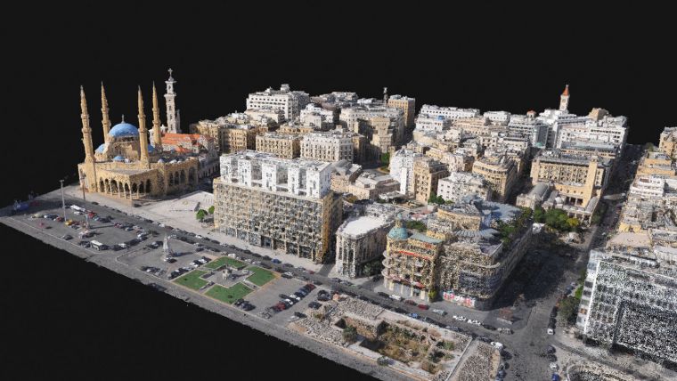
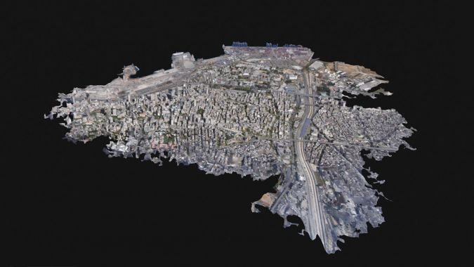
With city access difficult, an aerial map rapidly become the most realistic alternative since it could be created more quickly than a terrestrially scanned map. An aerial map would also provide more information about the status of buildings and their surroundings. The plan took shape to use unmanned aerial vehicles (UAVs or ‘drones’) to gather images of the city, and then process the data using photogrammetry software that could merge the imagery to create a 3D point cloud. The resulting model could then be used to inspect and measure the damage and subsequently determine where to begin with rebuilding.
Data Collection during a Crisis
Within a few days, through Open Maps Lebanon, Augment got the opportunity to meet NAR, Pix4D and Geospatial Minds. Together, they launched an initiative to provide the disaster relief effort with accurate 3D data of the disaster area, each having a specific role to fulfil: Geospatial Minds would provide licensed drones and pilots; Pix4D would provide software and processing solutions; the LiveLove Beirut organization would facilitate contact with the FER; back in Luxembourg, DCL Avocats would help with creating a superlative legal precedent with focus on General Data Protection Regulation (GDPR) and Creative Commons licensing for Open Data availability; Augment would provide coordination and lead the effort from a technical and practical point of view.
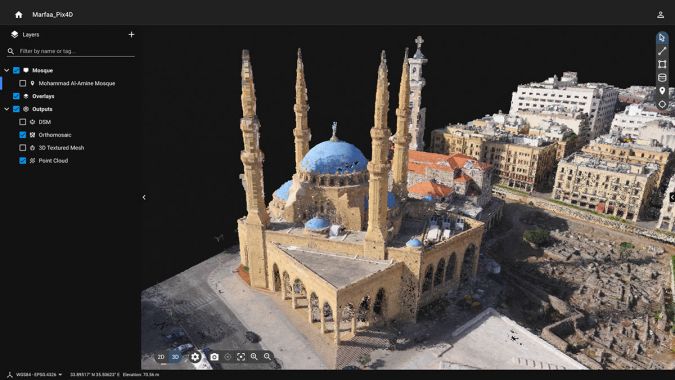
The team was assisted by the survey company Geospatial Minds, who provided a fixed-wing drone and specially trained pilots for the project. They used an eBee X drone with a S.O.D.A. 3D camera. The drone can fly for 90 minutes over an area of 5km2 at an altitude of 120m. With the use of PPK to ensure geolocational accuracy, the drone can provide results with precision to within 3cm.
Before the team could carry out any flights, the Lebanese government and military had to give permission to fly over the city. Due to the sensitive nature of the event, every rule had to be carefully followed. Only with official permission could the drone team take off.
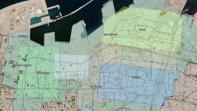
When the pilots flew, the camera on the drone was angled to be slightly oblique, which meant it could gather data to capture the facades of buildings as well as their surroundings. It took six separate flights to gather a total dataset of 13GB. The overall area surveyed was 2.88km2 over four hours.
Data was processed using desktop photogrammetry software capable of crunching large datasets – in this case, 4,000 images. With 20MP resolution, the images were perfect for providing in-depth analysis in a 3D model. The precision was ensured by PPK correction of the images after they were collected. Once the data was processed, it was shared using an online photogrammetry platform. This meant it could easily be accessed and used by different organizations, in line with the overall aim of the project.
Future Use of the 3D Model
Once the 3D model of the damaged area around the port was complete, it was shared with emergency responders in a large presentation. The impact was clear: a measurable, accurate replica of the city that anyone could use. The variety of applications it can be used for include blast modelling, emergency reconstruction, damage assessment, automated structural damage assessment, potential flood risk monitoring, urban planning, infrastructure impact and planning, multi-actor coordination, 3D layered information logging, and viewpoint analysis and calculation of potential roof use and rebuilding. It is a model for not just now, but for the future too. Thanks to it being shared under a creative commons licence, anyone can download it.
The crisis and impact of the Beirut explosion cannot be understated. Hundreds of thousands of people were affected. However, it was thanks to the use of modern technology and the cooperation of multiple organizations that this team could help in the recovery impact. The drone response was fast and effective, and the use of photogrammetry provided a resource for anyone to use, from emergency responders to residents.

Value staying current with geomatics?
Stay on the map with our expertly curated newsletters.
We provide educational insights, industry updates, and inspiring stories to help you learn, grow, and reach your full potential in your field. Don't miss out - subscribe today and ensure you're always informed, educated, and inspired.
Choose your newsletter(s)


