Unveiling Italy’s Hidden History with Fixed-wing Mapping UAVs
Mapping an archaeological site is key to being able to dig with greater precision. Now with the latest digital methods, areas of interest can easily be identified rapidly and non-invasively – helping to protect the site and future excavations. Here, Chris Thompson, Global Sales Manager at AgEagle, looks at how a team of Duke University researchers used the eBee X fixed-wing drone and RedEdge-MX multi-spectral camera to map a large archaeological site in Italy, to unveil a hidden history just below the surface.
Doganella, a small village in the Orbetello province of Rome in Italy, was once home to one of the most affluent and important Etruscan colonies of Etruria. Now it is the scene of a vast archaeological site, led by Duke University’s Professor Dr Maurizio Forte, where his team of researchers is working to preserve entire excavation sites. Using a combination of geospatial data recording, remote sensing and drone photogrammetry, the group is creating a 3D replica of the whole site – including its sister site at Vulci, near Montalto do Castro – to uncover buried structures and artifacts. These findings will help facilitate greater accessibility worldwide.
Recognizing Sites and Archaeological Features
Both sites have not been mapped or fully investigated yet, but 95% of the archaeological remains are estimated to be still buried – only accessible through remote sensing. Between June and December 2021, the team aimed to create classified maps of the landscape to accurately identify soil and crop marks, which would signpost archaeological buildings, graves, roads or other infrastructures. Already an advocate of digital methods for archaeological fieldwork, Dr Forte chose to use a drone to collect data and discover areas of interest. With both sites spanning around 700 hectares (1,730 acres), and resembling a modern-day farm field, it was important that the mapping solution could cover large amounts of ground quickly.
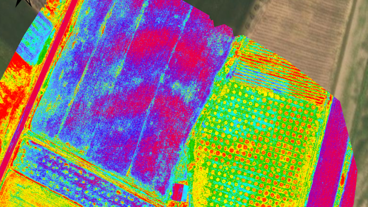
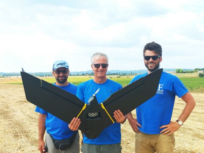
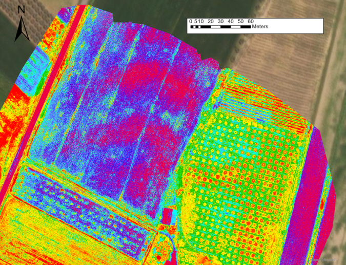
Using a long-range fixed-wing drone was the obvious choice for Dr Forte and his team, who opted for AgEagle’s eBee X. This would save valuable time and resources compared to traditional field walking surveys, which could take months to complete. They also paired the drone with a RedEdge-MX multispectral sensor, as vegetation and crops can crowd the landscape in the summer, making it difficult to recognize sites and archaeological features in RGB imagery alone. Instead, the 5-band multispectral sensor would help to classify the landscape by NDVI, to identify archaeological features related to the percentage of humidity, vegetation and crop growth.
Gathering Vital Insights
Flight planning in advance is a key part of gathering effective insights, to optimize battery life and ensure a seamless flight. The team integrated the hardware with eMotion software to simplify flight planning. With the help of 3D maps and built-in weather and wind data, Dr Forte could make more informed decisions both before and during the flights.
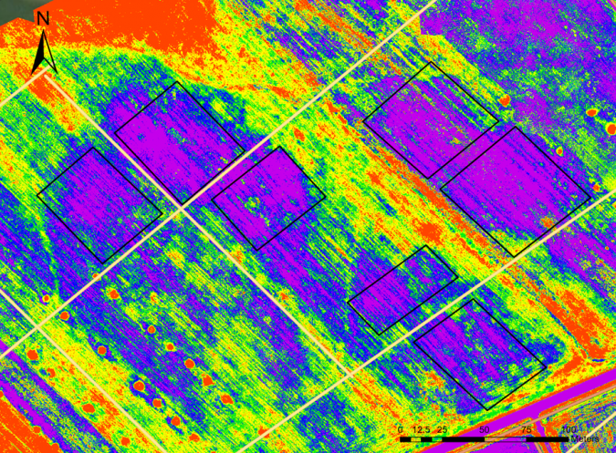
Over the space of a few weeks, the team flew the eBee X 20 times, collecting around 15,000 images, with 60-70% overlap – at an accuracy of 4.8 inch/pixel (12cm/pixel). These images were then processed in Pix4D and Metashape photogrammetry software to create a variety of outputs, including digital terrain models, point clouds, orthomosaics, spectral mapping and 3D models. With this high level of accuracy, the team could explore important features of the site in the terrain morphology, such as defensive walls, common in early settlements that were used to protect the colony against outsiders. Although these perimeters cannot be seen in RGB imagery, they are easier to spot using multispectral imagery and digital elevation models. AgEagle’s RedEdge-MX sensor was also crucial in recognizing numerous individual tombs, structures and large sections of the ancient street network still buried in the fields of these sites.
For Dr Forte’s team, using a combination of sensors proved particularly successful across several sites of interest. Imagery collected by the eBee X was an accurate guide for a secondary team using ground-penetrating radar (GPR), while multi-modal remote sensing extended the perspective of the site through a secondary reflectance map. Mapping such a large area would typically take months using traditional methods, but with the eBee X, a site-wide map could be created in a day. Thanks to its long battery life with up to 90 minutes of flight time, software and hardware integration and portability, the eBee X was the ideal choice for surveying and classifying the large archaeological site.
Transforming Excavation Sites with Digital Methods
Using the eBee drone and RedEdge-MX sensor to map both archaeological sites before bringing in other equipment helped to save valuable time and costs on this project. GPR equipment is typically costly to transport and operate, so having an accurate multispectral map of the entire site allowed the team to pinpoint exactly when it was needed on a very small scale.
Thanks to the findings on this project, Dr Forte’s team helped create a multi-layered archaeological landscape like never seen before. The accuracy of the multispectral imagery has been crucial to getting a better picture of the Etruscan landscape, as well as changing how the Tuscany landscape is seen today. Using this data will help the team plan future excavations in specific areas at Doganella and Vulci, while paving the way for the use of digital methods further afield on archaeological projects for years to come.

Value staying current with geomatics?
Stay on the map with our expertly curated newsletters.
We provide educational insights, industry updates, and inspiring stories to help you learn, grow, and reach your full potential in your field. Don't miss out - subscribe today and ensure you're always informed, educated, and inspired.
Choose your newsletter(s)


