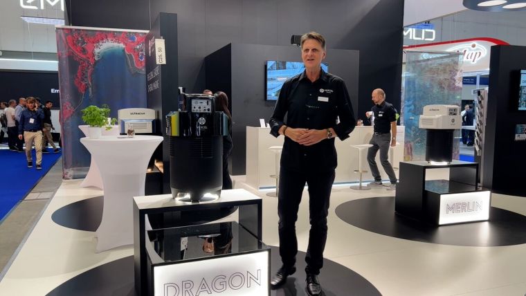
Vexcel Imaging advances aerial mapping with UltraCam Dragon 4.1
Recently unveiled by Vexcel Imaging, the groundbreaking UltraCam Dragon 4.1 represents one of the market's most advanced, progressively designed and seamlessly integrated hybrid aerial mapping systems. Tailored for high-resolution mapping of intricate urban environments and the creation of precise digital twins, the UltraCam Dragon amalgamates top-tier imaging and Lidar technologies, ensuring maximum collection productivity, high accuracy and improved target coverage.
"I am thrilled that we can offer the UltraCam Dragon 4.1, a system that opens up new perspectives for our customers," stated Alexander Wiechert, CEO of Vexcel Imaging. “The UltraCam Dragon 4.1 exemplifies our commitment to innovation and excellence in aerial mapping technology. It is poised to make a significant impact on industries and applications worldwide by providing the technology needed to explore, analyse and understand complex environments like never before.”
Combining oblique imaging and Lidar
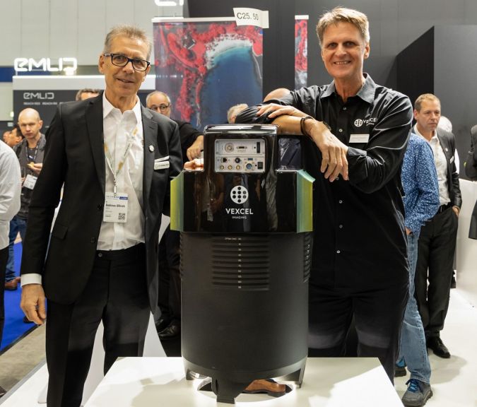
The new UltraCam Dragon 4.1 produces high-resolution nadir and oblique aerial imagery enriched with precise elevation information obtained by a powerful 2.4MHz RIEGL OEM Lidar scanner, collecting up to two million measurements per second. The Lidar’s innovative multi-axis scanning geometry, including a true nadir scan line, ensures maximum coverage of vertical features without occlusion in the steepest of building canyons and interior courtyards for truly impressive and complete digital twins. Two high-resolution nadir sensors (RGB Bayer pattern and NIR), along with four oblique (RGB) sensors, consistently deliver sharp, accurate and crisp imagery. This is achieved through advanced image processing techniques, including Vexcel’s proprietary Adaptive Motion Compensation (AMC) and True Pixel Processing (TPP). The integration of these best-in-class sensors results in a comprehensive and multi-dimensional information gain, facilitating in-depth analysis and a profound understanding of the as-built environment.
“We are delighted that Vexcel have chosen the RIEGL VQ-680 OEM Lidar module to integrate into their brand new, radical UltraCam Dragon 4.1 system design and thank our friends and colleagues at Vexcel for their trust and wish them all the best for a successful go-to-market with this new product,” commented Dr Johannes Riegl, CEO of the RIEGL Group, on the cooperation between the two long-term connected companies, both headquartered in Austria.
Panchromatic sensors
The system marks Vexcel’s first hybrid aerial mapping system for deep insights into complex environments at the highest collection rates. The integrated Lidar scanner, a RIEGL VQ-680 OEM sensor, has been unveiled to the market at Intergeo in Berlin, with Vexcel being the first company in the world to integrate this cutting-edge Lidar scanner into a turnkey solution.
With the introduction of the UltraCam Dragon 4.1 and UltraCam Merlin 4.1 at Intergeo 2023 in Berlin, Vexcel is expanding its offerings of aerial systems to cater to a wider range of applications in airborne photogrammetry. The fourth-generation UltraCam product lineup now encompasses three distinct categories: the Premium line, comprising the highly successful UltraCam Eagle 4.1, UltraCam Osprey 4.1, and UltraCam Condor 4.1 cameras with their established high-resolution panchromatic sensors; the Fundamental line, which consists of aerial cameras based on Bayer pattern sensors like the UltraCam Merlin 4.1 models; and the Integrated line, showcased by the newly unveiled UltraCam Dragon 4.1. This highly advanced hybrid aerial mapping system combines Lidar and image sensors, providing advanced capabilities for integrated data acquisition.
The Dragon 4.1 system is set to become available in mid-2024.

Value staying current with geomatics?
Stay on the map with our expertly curated newsletters.
We provide educational insights, industry updates, and inspiring stories to help you learn, grow, and reach your full potential in your field. Don't miss out - subscribe today and ensure you're always informed, educated, and inspired.
Choose your newsletter(s)


