Surveying and Positioning Systems
The world of surveying and positioning is experiencing an amazing transformation that began just recently, and goes hand in hand with the superior push in technology democratisation due to the popular...
In land surveying the exact position and shape of objects on the surface of the earth is mapped. Included in the position is the height of an object. Techniques used are for example the total station, level instrument and GNSS. There is a direct relation between modern Remote Sensing techniques and land surveying and topography and often they are used side by side with land survey techniques providing highly accurate coordinates and remote sensing providing a broader overview. In traditional land surveying and topography objects are located in x,y and z with the addition of an object type. However, nowadays more and more attribute information is collected as well allowing detailed databases and products to be developed in cartography.
An important application for land surveying and topography is in construction and engineering but also in for example land and water management. Where land surveying and topography is about the visible objects on the earth surface, marine surveying and bathymetry is concerned with the objects under the water surface.
The world of surveying and positioning is experiencing an amazing transformation that began just recently, and goes hand in hand with the superior push in technology democratisation due to the popular...

A laser scanner was deployed when a tunnel roof collapsed at a hydroelectric dam construction site in Bhutan. Surveying cavities in underground excavation projects can be difficult and dangerous. The...

In 2014, a joint publication by the World Bank and the International Federation of Surveyors (FIG) entitled 'Fit-for-Purpose Land Administration' noted that 75 percent of the world’s population do n...

Geospatial has always been considered as big data, both by its own advocates and many others, writes Ian Holt, a big data evangelist from the UK, in his latest column in 'GIM International'. Yet lar...
Mobile Mapping devices are a typical result of the on-going miniaturisation of instruments enabled by chip technology and electronics which result in small, handy, portable and accurate GPS tools that...

Technological monuments are vulnerable to decay. 3D modelling and documentation are essential to avoid them falling into irreparable decline and to enable future restoration. Terrestrial laser scannin...

Is it possible for crowdsourcing techniques to be more widely introduced into official cadastral surveys and land administration systems (LASs)? Are citizens able to actively take part in decision-mak...
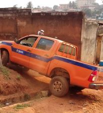
In Yaoundé, Cameroon, little cartographic data of the road network, public assets and utilities is available. To efficiently renovate the city’s drinking water network, mobile mapping technology wa...

Laser scanning has made data acquisition substantially simpler but the accurate analysis and registration of data requires both effective software and the core skills of the land surveyor. Is the soft...

For nearly a century, up until the 1960s, Africa was colonised by Europe. During this period the coloniser's laws replaced many traditionally enforced regulations. After independence the new African s...
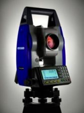
Servomotors move the total-station telescope horizontally and vertically to detect the prism. When detected, the system “zooms in”, aims, and locks onto the reflector of high accuracy. A Rob...
Depleting oil resources have led the United Arab Emirates (UAE) to begin investing heavily in other sectors, above all tourism and property. The resulting construction boom means 20% of the world’s ...
The land surveying and registration system in Namibia covers only part of the country. There is frustration at the slow pace of planning, survey and registration of land rights and access to credit fo...
The International Cartographic Association and the United Nations recently published the book Mapping for a sustainable world. The objective was to inform those interested in visualizing SDG indicator...

James Kavanagh, Land Group Director, reports on activities of, and relating to, RICS and gives some thoughts on thefts of surveying instruments. Winter is extending its icy grip across the UK but thin...
This site uses cookies. By continuing to use this website, you agree to our Cookies Policy. Agree