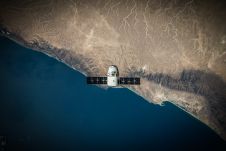
The role of surveyors in building climate resilience
New knowledge and tools are needed if surveyors are to fulfil their critical role along the path to achieving humanity’s global climate goals related to land, water and the marine...
New knowledge and tools are needed if surveyors are to fulfil their critical role along the path to achieving humanity’s global climate goals related to land, water and the marine...

Gravitational acceleration measurements were conducted in the Allgäu region of southern Germany by the Federal Agency for Cartography and Geodesy (BKG) in September this year. In high-altitude locations, helicopters were...
On 24 January 2023, the European Union declared the Galileo High Accuracy Service (HAS) operational for testing, and it is scheduled to become fully operational in 2024. This free signal adds...
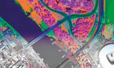
A pioneering project in Poland has proved that aerial mapping, combined with Lidar technology, can be an invaluable tool for accurately mapping the green urban environment. In fact, the new,...
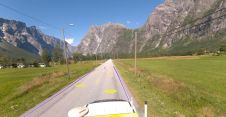
Field and Mosaic have jointly developed an advanced mobile mapping solution for road network management. Thanks to this successful collaboration, road asset managers and owners can now explore and interrogate...
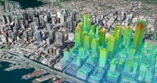
Thanks to the ability of digital twins to provide insights into the reality of present conditions and the impacts of future scenarios, they have the potential to revolutionize the planning...
What are the challenges of image-based data acquisition for photogrammetric mapping and mesh modelling? And how can photogrammetry be made accessible? The annual Open Day Photogrammetry provided some answers to...
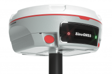
The Mars Pro Laser RTK is the third addition to ComNav’s Universe series of GNSS receivers, following on from the Venus Laser RTK and Mars Laser RTK. According to ComNav...
The Leica BLK2FLY is now able to scan indoors, providing expanded coverage for complex scanning projects. According to Leica Geosystems, part of Hexagon, the BLK2FLY now unlocks a new level...
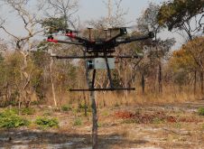
British mine-clearance charity The HALO Trust partnered with Routescene to undertake a UAV Lidar project in Cuito Cuanavale, in the Angolan province of Cuando Cubango. This case study demonstrates the...
This site uses cookies. By continuing to use this website, you agree to our Cookies Policy. Agree