UAV Remote Sensing for Smart Agriculture
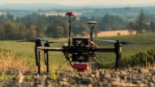
‘Smart agriculture’, i.e. the efficient use of Earth's resources to feed the world, requires accurate and advanced data acquisition, modelling and management. UAVs can play a critical role in this....
‘Smart agriculture’, i.e. the efficient use of Earth's resources to feed the world, requires accurate and advanced data acquisition, modelling and management. UAVs can play a critical role in this....
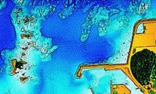
The ‘Umi-no-Chizu’ (‘Map of the Sea’) project will use aerial measurement to map 90% of Japan’s shallow coastal waters (to a depth of 20m). This is a joint project by...
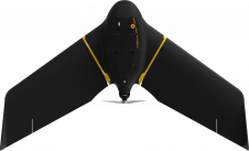
AgEagle’s eBee X series of fixed-wing UAVs are the first on the market to comply with the FAA's Category 3 of the 'Operations of Small Unmanned Aircraft Systems (sUAS) Over...
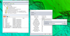
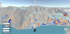
Established as an advanced and comprehensive geospatial software, Global Mapper Pro excels in terrain analysis, point cloud editing, drone-collected image processing and much more. Recent versions of the programme have...
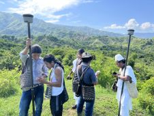
Local indigenous youngsters in northern Colombia have mapped the boundaries and sacred sites of their village, Gunmaku in the Sierra Nevada of Santa Marta, and the indigenous authorities are happy...
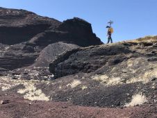
NASA researchers and their industry partners have developed a remote sensing mapping system to aid explorers in the most isolated wilderness imaginable: the airless wastes at the South Pole of...
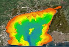
The national land agency in Jamaica has integrated satellite-based hydrography to benefit from time efficiencies, cost savings and improved safety as part of its hydrographic programme in support of the...
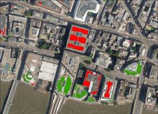
Bluesky International has supplied its high-resolution photography to support a new AI platform to map green infrastructure, aimed at identifying where biodiversity can increase in UK cities. The platform has...

Geodesists and surveyors in Iceland face considerable challenges due to the deformation effects of earthquakes, volcanic eruptions and glaciers on the geodetic networks. This article provides insight into the impact...
Lidar change detection (LCD) is one of the most capable techniques for mapping changing terrain through time. It can be applied in billion-dollar decisions to design, build and operate tunnels,...
This site uses cookies. By continuing to use this website, you agree to our Cookies Policy. Agree