Waterside Mapping in Italy
The combination of 3D-laser scanning and side-scan sonar can be very beneficial for mapping complicated waterside areas; the two systems are complementary. High-resolution surveys were performed over a two-year period...
The combination of 3D-laser scanning and side-scan sonar can be very beneficial for mapping complicated waterside areas; the two systems are complementary. High-resolution surveys were performed over a two-year period...
Intermap Technologies Corp. (CO, USA) has expanded its online offerings to include countrywide and state-wide SRTM (Shuttle Radar Topography Mission) elevation datasets, contours and Global Mapper geospatial software. All of...
More than five hundred exhibitors from 32 countries are due to put in an appearance at Intergeo 2008, presenting a comprehensive overview of the geo(infor)matics business today. Covering a wide...
The Sixth Annual International Conference and Exposition on Laser Scanning and Digital Aerial Photography, ‘Today and Tomorrow’, was held at the President Hotel in Moscow from 6th to 8th December....
INPHO (Germany) has announced the launch of a new version of DTM administration software, DTMaster V1.1.0. The software has been designed for checking, editing, visualisation and classification of 3D point...
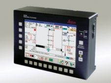
Leica Geosystems (Switzerland) has released new versions of its FCMS (Flight & Sensor Control Management System) and FPES (Flight Planning & Evaluation Software). FPES is an office tool for flight...
INPHO (Germany) has announced launching of a new version of its fully automatic DTM generation software, MATCH-T 4.0. The major changes and improvements compared to the previous versions are: processing...
Leica Geosystems Geospatial Imaging (CA, USA) has released Leica Photogrammetry Suite (LPS) 9.1. The introduction of Leica Terrain Format (LTF) provides improved accuracy and processing over LPS 9.0. LTF supports...
Carlson Software (KY, USA) has introduced Carlson SurvCE 2.0, a complete data collection system for Real Time (RTK) GPS and Total Stations. Carlson SurvCE 2.0 combines a tab-based menu structure...
SITIBSA, Serveis d’Informació Territorial de les Illes Balears (Spain), with their headquarters in Palma de Mallorca, have recently acquired the whole INPHO production line to fulfil their needs in terms...
This site uses cookies. By continuing to use this website, you agree to our Cookies Policy. Agree