Found 307 results
Sort by

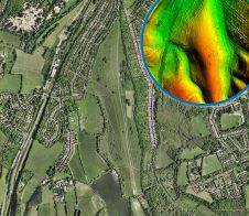
The Race to Resurface Silverstone

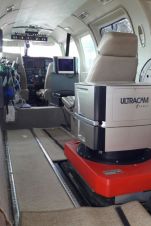
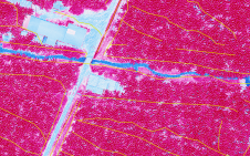
Lead contractor Tarmac, along with its industry leading road planing business, NRP, racetrack specialist Dromo and project partner Topcon Positioning Group, combined expertise with innovative surveying and measuring technology to ensure...

Read more

Updating the Cadastre in Ecuador

Photogrammetry and Lidar were used together in Ecuador to detect irrigation and drainage canals for a project aiming to improve irrigation methods and create the related land registry. The integration...

Read more

3D is the New Normal in Switzerland

Switzerland is unique in that it is still the only country to have switched entirely to 3D for its national object-oriented topographic database. As users increasingly discover the advantages in...

Read more

Sensor Fusion for Precision Agriculture

Precision agriculture has considerably benefited from the use of unmanned aerial vehicles, often combined with active ranging sensors like Lidar to gather information from underneath the crops, but existing systems...

Read more