Claudio Persello
Claudio Persello is an adjunct professor at the Faculty of Geo-Information Science and Earth Observation (ITC) of the University of Twente. His main research interests are in the context of...

Claudio Persello is an adjunct professor at the Faculty of Geo-Information Science and Earth Observation (ITC) of the University of Twente. His main research interests are in the context of...
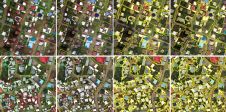
From drones and satellites to airborne-based sensors and Lidar, advances in remote sensing and geospatial information science are driving the development of innovative methods for data acquisition, processing and maintenance....
SkyWatch has been selected by the Canadian Space Agency (CSA) to complete Phase 2 of the Artificial Intelligence and Big Data Analytics for Advanced Autonomous Space Systems challenge. This award...
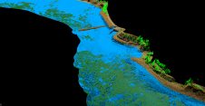
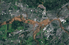
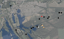
As part of a Catalan government project to improve the management of its marine environment, ICGC cooperated with Field to use airborne Lidar bathymetry (ALB) to survey the Catalan coastal...
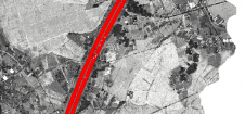
Thanks to rapid improvements in aerial laser scanning systems, they offer great potential in road surveying compared with traditional photogrammetry-based methods. Using the high-density 3D point clouds resulting from aerial...
The International Association of Landscape Archaeology (IALA) has chosen a PhD thesis titled 'Learning to look at Lidar: combining CNN-based object detection and GIS for archaeological prospection in remotely-sensed data'...
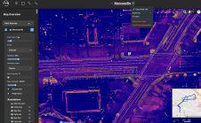
The Mach9 software platform produces 2D and 3D maps from mobile Lidar 30 times faster than existing solutions, according to the North American company. This is the first product launched...

Bentley Systems and WSB are collaborating to promote the use of infrastructure digital twins in civil infrastructure projects. WSB, an American design and consulting firm, has launched a digital construction...
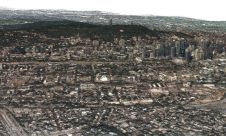
Concordia University researchers have developed a faster and more accurate technique for creating highly detailed 3D models of large-scale landscapes. With this technique, digital replicas of real-world environments can be...
Serving as a former co-chair of UN-GGIM and a long career in the geospatial arena, Tim Trainor has a deep understanding of the value of the UN-IGIF. He serves as...
This site uses cookies. By continuing to use this website, you agree to our Cookies Policy. Agree