Found 230 results
Sort by

Tender: Norway - Aerial Mapping Services

The Norwegian Polar Institute would like tenders for aerial photography on Svalbard by a digital high resolution aerial camera. GPS/INS shall be used for geo-references. Bidding Type International Competitive Bidding...

Read more

Mapping with Digital Cameras

Over the period from December 2004 to 2008 the Institut CartogrĂ fic de Catalunya, Spain, took nearly 200,000 digital aerial images using two Digital Mapping Cameras (DMC) to replace analogue RC30...

Read more

Intergeo Preview 2009

Intergeo, the world’s largest congress and trade-fair for geodesy, geoinformation and land management, will this year be held in Karlsruhe, Germany, from 22nd to 24th September. About 16,000 visitors are...

Read more

Affordable Precise Positioning

GPS is good for perhaps 70% of surveying needs. Inertial Navigation is the forgotten friend of GPS. Traditionally complex and expensive, Inertial Navigation has become competitive, easy-to-use and cost-effective. Need...

Read more

SBG Systems

SBG Systems is a leading supplier of inertial motion sensing solutions, from miniature to high accuracy. Combined with cutting-edge calibration techniques and advanced embedded algorithms, SBG Systems’ products are ideal...

Read more

Radar Sheds Light on Cumbria's Secrets

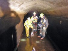
SM Pelorus have completed Ground Penetration Radar (GPR) work valued at GBP10,000 to analyse the buried structure of Thirlmere Aqueduct (Cumbria, UK), the 84 mile-long Victorian water pipe connecting the...

Read more