A Journey into the New Reality
In which direction is the geospatial industry heading? Which core activities will companies focus on? How will the rapidly progressing technological advances shape the future? The recent edition of HxGN...

In which direction is the geospatial industry heading? Which core activities will companies focus on? How will the rapidly progressing technological advances shape the future? The recent edition of HxGN...

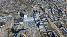
Bluesky International is using one of the world’s most advanced hybrid sensors to expand its library of high-definition oblique photographs of UK cities to reveal more detail than ever before...
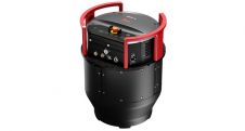
Leica Geosystems, part of Hexagon, has launched the Leica DMC-4, a highly efficient airborne imaging sensor providing unsurpassed image quality for various applications and complex mapping environments. With the new...
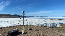
Researchers from the Bureau of Economic Geology have spent the summer in northwestern Greenland conducting research using an airborne Lidar system. The project – Airborne Lidar surveys to quantify Greenland...
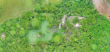
While it is possible to capture ancient Maya sites hidden beneath jungle canopy in remote locations using airborne Lidar, identifying them is still a time-consuming process. Typically, 3D point clouds...
Leica Geosystems, part of Hexagon, has announced the introduction of Leica Chiroptera-5, the new high-performance airborne bathymetric Lidar sensor for coastal and inland water surveys. This latest mapping technology increases...

The Leica AP20 AutoPole from Leica Geosystems is a unique easy-to-use smart system for automated total stations that boosts on-site productivity and opens up new possibilities as the world’s first...
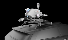
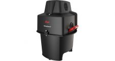
Leica Geosystems has launched a reality capture mobile mapping system called Leica Pegasus TRK, introducing artificial intelligence, autonomous workflows and intuitive interfaces. The Leica Pegasus TRK solution utilizes artificial intelligence...

In this interview, Thomas Harring, president of Hexagon’s Geosystems division and CEO of Leica Geosystems, shares his thoughts on the present and future of the geospatial industry, including his views...
Smart digital realities that replicate real-life geoinformation provide valuable insights and support the analysis and interpretation of infinite data inputs from the real or digital world. They can be used...
This site uses cookies. By continuing to use this website, you agree to our Cookies Policy. Agree