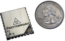
Found 62 results
Sort by

GPS and GIS for the Blind

To date the visually impaired have received navigational aid from a wide range of technologies such as tactile maps, tactile graphic displays, acoustic devices, distance measurement by ultrasound or laser,...

Read more

Intergeo Preview 2009

Intergeo, the world’s largest congress and trade-fair for geodesy, geoinformation and land management, will this year be held in Karlsruhe, Germany, from 22nd to 24th September. About 16,000 visitors are...

Read more

Mobile Mapping

Mobile mapping systems can quickly and accurately acquire geo-data at a high level of detail. Features especially beneficial in urban areas where construction and layout rapidly change and traditional surveying...

Read more

Mobile GIS Systems

Today the computer power of handheld devices is comparable to the desktop computers of a few years back. Together with rapid adoption of the internet, this progress has triggered fitting...

Read more

Intergeo Preview 2011 (2)

Everyone who truly matters in the geomatics and surveying-related business will be travelling to Germany ¨C or more precisely to the Bavarian city of Nuremberg ¨C in the last week...

Read more

NigeriaSat-2 Completed Pre-launch Testing

The latest Earth observation satellite from UK small satellite manufacturer SSTL has successfully completed pre-launch tests and has been integrated with a Dnepr launch vehicle. NigeriaSat-2, one of the most...

Read more

Teledyne Technologies to Acquire DALSA

Teledyne Technologies and DALSA (Canada) have announced that they have entered into a definitive agreement that provides for the acquisition of DALSA by a wholly-owned subsidiary of Teledyne. Headquartered in...

Read more

UAVs and the Built Environment

My Endpoint column in the February 2011 issue touched upon general characteristics of Unmanned Aerial Vehicles (UAV). Here, I focus on low-weight, low-altitude and the built environment. Low-weight UAVs are...

Read more