State of the art in 3D city modelling
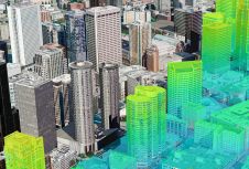
How does 3D city modelling fit within the context of broader developments such as smart cities and digital twins? And which six challenges must be overcome before 3D data as...
How does 3D city modelling fit within the context of broader developments such as smart cities and digital twins? And which six challenges must be overcome before 3D data as...
How can we address the need for frequent large-scale mapping in order to model real-time change? In this column, John Welter, president of geospatial content solutions at Hexagon Geosystems, zooms...
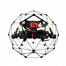
Flyability and Pix4D recently announced a partnership agreement to offer bundled Flyability and Pix4D products. The bundle will be sold in the form of a photogrammetry add-on that can be...
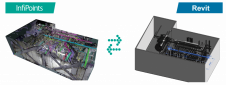
Elysium has developed an advanced functionality to model piping and structures from 3D laser scanned point clouds into Autodesk Revit. This new capability is included in Elysium’s point cloud utilization...
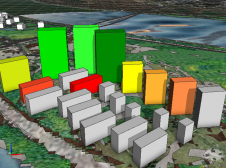
Rapid urban development in China has transformed the cityscapes, with a dramatic increase in high-rise buildings. However, the current 2D property valuation methods neglect the vertical dimension, even though that...
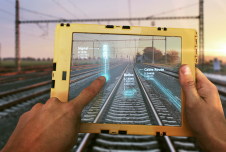
To maintain reliability and safety for passengers and freight, many of Europe’s rail networks are undergoing a massive digital modernization programme that includes digital twins. Backed by artificial intelligence (AI),...

The curtains have fallen on Intergeo 2023. What were the key takeaways from the vibrant three-day event in Berlin? From 10-12 October, a diverse array of experts and enthusiasts from...
SimActive, one of the leading developers of photogrammetry software, has announced the release of version 8.0 with a new 3D modelling module for Correlator3D. The module allows the generation of...

Surrey Fire and Rescue Service (SFRS) are benefiting from using Cadcorp SIS Desktop and Workload Modeller for a range of GIS analyses. Cadcorp SIS is used to carry out various...
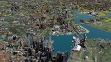
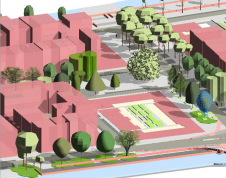
No modern city is future-proof without a ‘digital twin’: the 3D city model. 3D city models are virtual representations of urban environments and include buildings, terrain, infrastructure, landscapes, vegetation and...
This site uses cookies. By continuing to use this website, you agree to our Cookies Policy. Agree