7 Inspiring Articles on 3D City Modelling
No modern city is future-proof without a ‘digital twin’: the 3D city model. 3D city models are virtual representations of urban environments and include buildings, terrain, infrastructure, landscapes, vegetation and landmarks. This series of articles on projects in cities such as Singapore emphasises the value and importance of 3D city modelling and highlights its many potential applications.
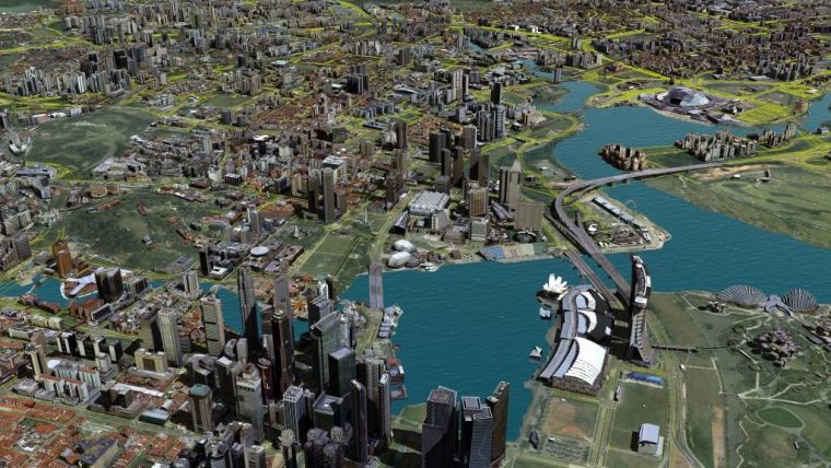
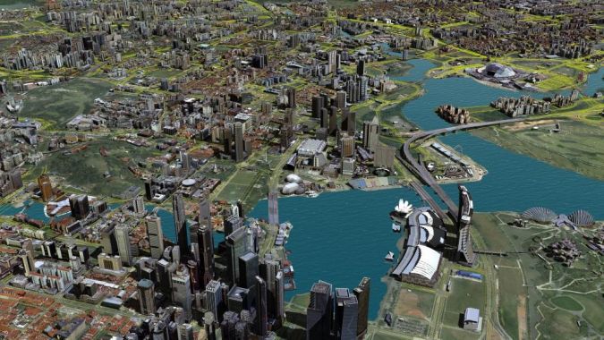
Singapore: Towards a Smart Nation
Since the inception of its Smart Nation programme in 2014, Singapore has emerged as a world leader in smart city initiatives. One of the centrepieces of Singapore’s strategy has been the development of a highly accurate 3D digital map of the country to support key functions such as urban planning, flood control and civil aviation. The creation of this national 3D map has involved the use, adoption and development of world-leading surveying, mapping and GIS technologies. Read on for an article explaining the various challenges in creating and maintaining the required data, and how it will be used to its fullest potential. Read on...
Web-based 3D in Urban Planning
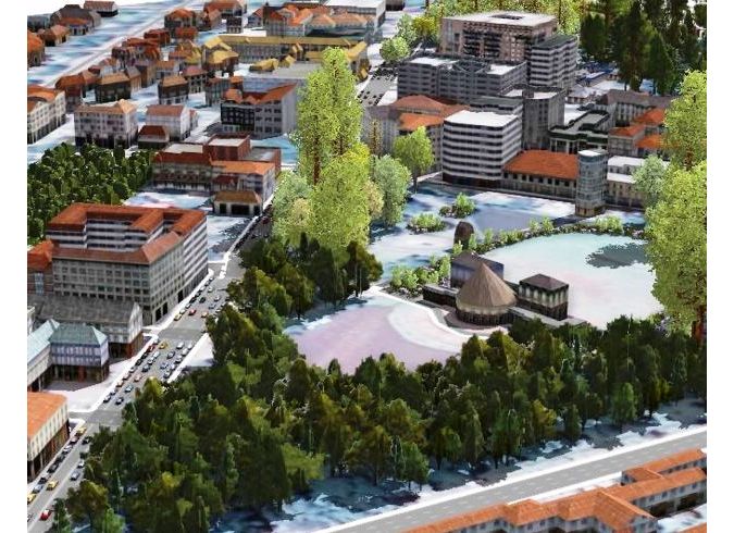
Urban planning has become more complicated due to today’s rate of urbanisation and the rapid expansion of cities. Web-based 3D tools coupled with high-quality 3D city models and digital terrain models offer viable solutions. Although the majority of plans are still produced in 2D, there is a growing trend towards 3D. Read on for examples and discussion of some critical success factors. Read on...
3D GIS in China
Since 1998, the Chongqing Survey Institute (CSI) has been managing the 3D geoinformation database, including terrain, buildings, underground pipelines, geology and underground buildings, of the Chinese megapolis of 30 million people. For the commercial market, CSI’s 3D Mobile group focuses on combining the indoor and outdoor environment with e-commerce systems. Meanwhile, its BIM and GIS Integration group concentrates on three fields: geological survey, construction sector and municipal administration. Read on...
Dense Image Matching for Easy 3D Modelling
Normally when something is too good to be true, it is not true. But in the case of dense image matching (DIM), professional surveyors should look twice – because their clients, and certainly those in the construction, infrastructure and 3D city mapping markets, certainly will. ‘GIM International’ asked John Taylor, who is responsible at Bentley Systems for reality modelling in Asia Pacific and in the global defence market, for his insights into DIM. Read on...
Public Participation Using 3D City Models
The importance of involving the general public in the design of urban plans and development scenarios is widely recognised. Today’s web technology and availability of 3D city models at various levels of detail enable local governments to communicate spatial plans effectively to their citizens. They also enable citizens to comment on and propose alternatives, thus providing feedback to local authorities. This means public participation is enhanced through e-participation. Read on for details of the opportunities offered by e-participation in Kenya. Read on...
New 3D Map Solution Covering Norway
Worldwide, most municipalities are still making regular 2D maps for online publication, including maps for zoning plans, municipal plans, property borders as well as approved sites for new construction projects. However, the ‘man on the street’ has little or no knowledge of how to read such maps. Norkart in Norway has now launched a brand-new 3D map solution, Kommunekart 3D, which covers the whole country and has the potential to revolutionise map use. Read on...
Read also our interview with 3D city model expert Filip Biljecki, ‘The Tough Road from 2D Maps to 3D City Models’. Biljecki zooms in on the crucial role of the abstraction of the 3D real world, a concept known as level of detail (LoD). Since 2012 Dr Filip Biljecki has been investigating how to improve the level of detail (LoD) in 3D city models. For his efforts – which were published in a hefty book called ‘Level of detail in 3D city models’ – he recently received a PhD degree from Delft University of Technology. In acknowledgement of the high standard of his research, he graduated with the rarely awarded cum laude distinction.

Value staying current with geomatics?
Stay on the map with our expertly curated newsletters.
We provide educational insights, industry updates, and inspiring stories to help you learn, grow, and reach your full potential in your field. Don't miss out - subscribe today and ensure you're always informed, educated, and inspired.
Choose your newsletter(s)


