Wingtra Unveils Multispectral Camera with Panchromatic Sensor
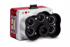
Wingtra has launched its new MicaSense RedEdge Panchromatic (RE-P) payload. Capturing with the same five bands as the time-tested RedEdge-MX, the RE-P introduces a panchromatic sensor for enhanced resolution, life-like...