Found 124 results
Sort by

Integrating GNSS and INS

GNSS provides accurate positional information with relatively low integrity, while INS offers position and attitude information subject to drift but with relatively high integrity. Integrating the two provides reliable and...

Read more

MDL Released Void Scanner 150

Measurement Devices Ltd (MDL) (United Kingdom) has released a new void scanner for on-the-spot, underground mine surveys; the Void Scanner 150 (VS150). Developed mainly for use in underground mining, the...

Read more

Magellan DG14 RTK GPS Board

Magellan (France) has introduction the DG14 RTK which offer high-end precision in a low-cost GNSS unit. The DG14 RTK from Magellan is a cost-effective, sub-metre GNSS (GPS and SBAS) and...

Read more

Van Oord

Established in 1868 by Govert van Oord, Van Oord is today a conglomerate of Dutch dredging companies, lately best known as constructor of Palm Island, Dubai, the ‘Eighth Wonder of...

Read more

Data Integration for Coastal Surveying

When surveying the coastline, the integration of bathymetric (below sea level) and laser scanning (above sea level) data causes problems due to the different imaging properties. However, by ensuring that...

Read more

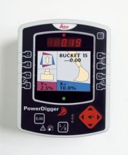
Leica PowerDigger

With the new Leica PowerDigger Excavator Guidance System, Leica Geosystems (Switzerland) presents its latest in a line of site proven guidance systems. Increased operator and machine productivity leading to reduced...

Read more

Intergeo Preview 2009

Intergeo, the world’s largest congress and trade-fair for geodesy, geoinformation and land management, will this year be held in Karlsruhe, Germany, from 22nd to 24th September. About 16,000 visitors are...

Read more

Modelling the Great Wall of China

The Great Wall of China is one of the largest manmade wonders of the world, comprising many different and irregular structures. We employed airborne Lidar to produce highly accurate digital...

Read more

Ixsea Releases LANDINS and AIRINS

Ixsea (France) has released LANDINS, a land survey solution which provides position, heading, roll and pitch. It offers high-accuracy position and orientation data in real-time, even in tough environmental conditions....

Read more