Found 231 results
Sort by

Ixsea Releases LANDINS and AIRINS

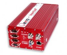
Ixsea (France) has released LANDINS, a land survey solution which provides position, heading, roll and pitch. It offers high-accuracy position and orientation data in real-time, even in tough environmental conditions....

Read more

Modelling the Great Wall of China

The Great Wall of China is one of the largest manmade wonders of the world, comprising many different and irregular structures. We employed airborne Lidar to produce highly accurate digital...

Read more

ESRI Becomes Océ Reseller

ESRI (CA, USA) has become a national reseller of Océ TCS300 large-format colour printers and Océ TCS500 colour multifunction copy/scan/print systems. This new agreement presents a total business solution for...

Read more

Worldview-1 Imagery General Available

WorldView-1 has reached Full Operating Capability (FOC) for all customers. The general availability of WorldView-1 imagery marks the final milestone for the satellite which launched from Vandenberg Air Force Base...

Read more

Hexagon Expands European distribution

Hexagon has acquired all outstanding shares in four companies; R&A Rost Vertriebs GmbH, R&A Rost Produktions GmbH, both in Austria, Geopro Kft. in Hungary, and Junglas GmbH in Germany. The...

Read more

OxTS Launches New Intertial+ Product

OxTS (United Kingdom) has released the new Inertial+ product. Signals from your GPS receiver can be blocked or reflected by buildings and trees. In combination with the new Inertial+ system...

Read more

New Routescene GPScamera Unit

Routescene has announced a series of enhancements made to the integral GPScamera unit. The improved tilt facility on the GPScamera means that tools are no longer needed to adjust the...

Read more