A Company with Direction
iXSea's strength is in technology. Of its roughly 200 employees, a third are engaged in R&D. The company holds 21 key patents in the area of navigation and positioning -...

iXSea's strength is in technology. Of its roughly 200 employees, a third are engaged in R&D. The company holds 21 key patents in the area of navigation and positioning -...

The ICA page in this magazine twelve months ago described the significant number of cartographic events and developments taking place in Eastern Europe. Under the spotlight here is one output,...
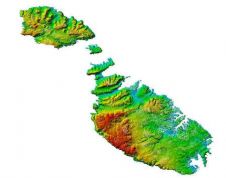
TerraImaging, Germany/The Netherlands, has successfully finalised high-precision airborne data capture of the Maltese archipelago, from ocean floor to church spires, and work is well underway to complete one of the...

COVER STORY Our cover image shows Blom's coverage over Bristol; BlomOBLIQUE at 5cm with a 3D point cloud generated from their MetroHD vertical imagery. Turn to page 14 for the...
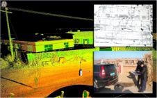
A team of shipwreck hunters have turned to advanced 3D mapping technology to locate sunken vessels along the South Australian coastline without getting their feet wet. A group of shipwreck...
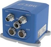
SBG Systems recently has added a new inertial system to its Ekinox series. With integrated Dual Antenna GPS + GLONASS receiver, the Ekinox-D is a ready-to-use Survey Grade inertial navigation...
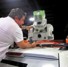
Leica Geosystems has introduced its next-generation vehicle-independent mobile mapping platform. By calibrating imagery and Lidar point cloud data, the Pegasus:Two delivers highly accurate geospatial data in a 360° spherical view...
This year’s HxGN Live, Hexagon Metrology’s annual user conference, was once again held in Las Vegas, USA, from 2-6 June. Its maxim: ‘Great Stories Start Here’. From a geomatics point...

To be useful, the millions or even billions of 3D points generated by a variety of active and passive sensors need to be stored, organised, combined, georeferenced, measured and analysed,...
Collecting and processing point clouds has been trending topic in the geospatial sector over the past few years. This article focuses on point cloud processing software aimed at creating DEMs...
This site uses cookies. By continuing to use this website, you agree to our Cookies Policy. Agree