Found 489 results
Sort by

Strabo Photogrammetry 10.5 Launched

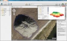
Orbit GeoSpatial Technologies has released its photogrammetric UAS mapping application of Orbit Strabo Photogrammetry 10.5, and the update is immediately available for download. This upgrade adds new features on several...

Read more

Fixed-wing UAS

Monitoring a nuclear power plant construction site requires regular collection of site data; even up to weekly coverage may be necessary. Conventional photogrammetry and land surveying are often too costly....

Read more

UAS Provide Humanitarian Aid in Haiti

UAS from senseFly, Switzerland, have accomplished their second mission in Haiti to map areas around Port-au-Prince and Cap Haitien, including areas that were damaged by Hurricane Sandy in October 2012....

Read more