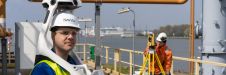
Preserving history in the high Arctic
Nestled in the high Arctic Archipelago of Svalbard, the Sveagruva coal mine and mining settlement once buzzed with activity until its closure in 2016. An extraordinary project is now underway...
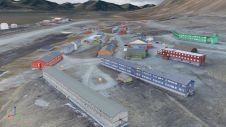
Nestled in the high Arctic Archipelago of Svalbard, the Sveagruva coal mine and mining settlement once buzzed with activity until its closure in 2016. An extraordinary project is now underway...
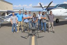
Condor Aviation, a partnership between the Yurok Tribe’s Fisheries Department and the Yurok Tribe Construction Corporation, acquired a RIEGL Lidar sensor to collect data that will inform natural resource management...

The University of Bradford has taken delivery of the UK’s first Leica TRK700 Evo – a vehicle-mounted mobile mapping system capable of capturing two million data points every second to...
Which factors contribute to the slow adoption of TLS in Nigeria? These insights can help to stimulate the uptake of instrumentation and enhance professional surveying in other developing countries across...
Artec 3D has introduced the Artec Ray II, a highly precise 3D Lidar scanner specifically designed for digitizing large objects and spaces with exceptional speed and accuracy. Artec 3D is...
In the first episode of NavVis’ new podcast series, we hear revelations from world experts about the past, present and future of reality capture and documentation. In the first episode of NavVis’ new podcast series, we hear revelations from world experts about the past, present and future of reality capture and documentation. ‘Scanning Realities’ is the...
A new partnership marks a significant milestone in the field of reality capture: NavVis has selected Hesai as its exclusive Lidar sensor provider for its industry-leading device, the NavVis VLX...
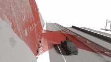
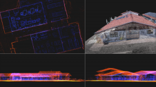
Exploring the complete potential of mobile laser scanning raises the question of whether the obtained results are sufficiently accurate for deformation monitoring. This article focuses on the geometric quality of...
Trimble has recently announced the Trimble X9 3D laser scanning system, a versatile reality capture solution for surveying, construction and engineering professionals. The X9 is built on Trimble's proven laser...
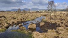
An annual airborne laser scan of the diverse landscapes in Scotland is being considered to monitor the health of the nation's forests, peatlands and natural ecosystems, according to a report...
This site uses cookies. By continuing to use this website, you agree to our Cookies Policy. Agree