Stonex unveils hybrid mobile real-time mapping solution
Stonex has launched a new SLAM solution for fast and efficient large-area surveys: the X70GO SLAM laser scanner. It combines mobile scanning with a stationary mode to scan with higher...
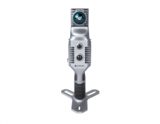
Stonex has launched a new SLAM solution for fast and efficient large-area surveys: the X70GO SLAM laser scanner. It combines mobile scanning with a stationary mode to scan with higher...

Founded in 2017, ZZCOMM technology of geospatial hardware and software solutions provides rapid and high-accurate geospatial data for BIM, mining AEC, survey and mapping industries, whether they are indoor, outdoor,...
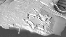
A Canadian archaeologist is using advanced mapping and visualization technologies to bring one of the earliest European settlements in North America back to life. Dr Jonathan Fowler combined a centuries-old...

Aerial mapping company Bluesky is to use Lidar to produce a highly detailed 3D map of the National Trust's Wallington Estate in Northumberland, England. The survey will bring to life...
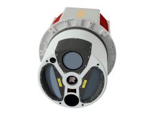
ClearSkies Geomatics, based in Colorado, USA, has recently added the RIEGL VQ-1560 II-S airborne laser scanner to its growing rental system fleet. This laser scanner, an advancement of RIEGL's dual-channel...
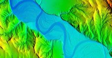
Teledyne Optech, the Canada-based advanced Lidar sensors company, has extended its Galaxy line-up to include the CM2000, a new sensor specifically designed for corridor mapping. With a true measuring rate...
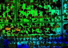
Woolpert has secured a contract with the University of Wyoming to generate a digital terrain model and contours. Leveraging Lidar data previously acquired for the United States Geological Survey (USGS),...

3D Target has continued to make significant advancements since launching its inaugural Scanfly model at Intergeo in 2016, at a time when Lidar technology in the UAV industry was still...

Lidaretto is flexible and compact Lidar scanning system developed since 2015 and uniquely designed to be used the way that fits best to users’ specific application. You can easily mount...

Denmark-based company Airborne Lidar Mapping A/S conducted a demanding data acquisition project in the summer of 2019. The purpose of the resulting data was to enable digital terrain models and...
This site uses cookies. By continuing to use this website, you agree to our Cookies Policy. Agree