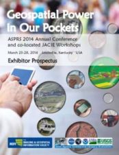
Found 143 results
Sort by

Experimenting with Low-cost UAVs

The use of Unmanned Aerial Vehicles (UAVs) as serious remote sensing platforms is a growing trend. They are already used in fields such as archaeology, construction, disaster relief, and the...

Read more

Multispectral Aerial Cameras

Today’s spatial applications increasingly require very high-resolution multispectral images with photogrammetric accuracy. The Hungarian Interspect Research Group recognised this trend in 2006 and developed a series of cameras to satisfy...

Read more

A Field Trip to Rhodes

The ancient Hellinistic settlement of Vassilika of the Kingdom of Kymissala is located in the eastern part of the island of Rhodes, between the modern towns of Monolithos and Lakki....

Read more

A Smarter Future for Geomatics

Thomas Kersten is a professor of photogrammetry and laser scanning at HafenCity University Hamburg, Germany. He is currently also one of the ‘directors’ of the Oldenburger 3D-Tage, an annual conference...

Read more

Riegl Wins 2014 MundoGEO#Connect Award

Riegl was honoured to accept the 2014 MundoGEO#Connect Award for Most Memorable Brand of Terrestrial Laser Scanner at the MundoGEO#Connect Latin America 2014 Conference and Trade Fair of Geomatics and...

Read more