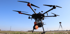
Drones: Now and in the Future
The drone industry is rapidly growing and will continue to expand in the future. Unmanned aerial vehicles (UAVs) make various applications easier, such as commercial delivery, mapping and search &...

The drone industry is rapidly growing and will continue to expand in the future. Unmanned aerial vehicles (UAVs) make various applications easier, such as commercial delivery, mapping and search &...

Land Surveying Drone solutions collect accurate, geo-tagged data quickly, while photogrammetry software processes these data to deliver standardized outputs. Learn how drones elevate land surveying Urban Planning Drone data creates...

Harxon Corporation, founded in 2008, is a customer-focused enterprise carrying out innovative R&D, manufacturing and selling in the fields of high-precision GNSS antennas and ultra-reliable wireless data transmission radio modems...

HERE Technologies, a leading location data and technology platform, has released high-fidelity, 3D models of 75 city centres around the world to give software developers the geospatial data needed to...
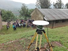
In line with the United Nations resolution to adopt a global geodetic reference network, the Government of Uganda received financing from the World Bank towards the cost of a competitiveness...

UP42 has announced that image data and information from the planned LatConnect 60 constellation of mid-inclined orbit remote sensing satellites will be available on the UP42 developer platform for Earth...

Bridging the gap between the physical and digital world. NavVis enables service providers and enterprises to capture and share the built environment as photorealistic digital twins. Our SLAM-based mobile mapping...

Bluesky International is co-funding research into the use of Lidar, machine learning and artificial intelligence to create citywide maps of trees enriched with new levels of information in an advanced postgraduate...

Pix4D, the Switzerland-based technology pioneer and one of the market leaders in industrial photogrammetry software solutions, has announced that it is starting a joint innovation project with SAP to open...
GeoSLAM has partnered with UK-based drone specialist Heliguy to provide professionals with sophisticated aerial mapping solutions. Drones have become a crucial tool for collecting accurate survey data quickly and safely, also...
This site uses cookies. By continuing to use this website, you agree to our Cookies Policy. Agree