Found 1956 results
Sort by

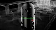
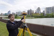
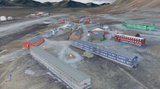
Mapping altitudes in the Alpine region

Gravitational acceleration measurements were conducted in the Allgäu region of southern Germany by the Federal Agency for Cartography and Geodesy (BKG) in September this year. In high-altitude locations, helicopters were...

Read more

Redefining reality capture with BLK2GO PULSE

Leica Geosystems, part of Hexagon, has officially announced the Leica BLK2GO PULSE. This innovative first-person laser scanner merges state-of-the-art Lidar sensor technology with the iconic Leica BLK2GO design, representing a...

Read more

CHCNav introduces AlphaUni 20 Lidar system

The AlphaUni 20 (AU20) Lidar system represents a new era in cost-effective, multi-platform mobile mapping solutions, according to CHC Navigation (CHCNav), a global leader in precision mapping, positioning and navigation...

Read more

Preserving history in the high Arctic

Nestled in the high Arctic Archipelago of Svalbard, the Sveagruva coal mine and mining settlement once buzzed with activity until its closure in 2016. An extraordinary project is now underway...

Read more