3D Laser Scanning Workflow Integration
Bentley is organising a webinar on 7th January 2010 highlighting the integration of Pointools Vortex Engine in Bentley Technology Platform. On 14th October 2009, Bentley Systems Inc. announced that it...
Bentley is organising a webinar on 7th January 2010 highlighting the integration of Pointools Vortex Engine in Bentley Technology Platform. On 14th October 2009, Bentley Systems Inc. announced that it...

The Icelandic authorities have commissioned Acecore to map the extent and aftermath of the Eldvörp-Svartsengi volcanic system eruption using its high-end drone solutions. Grindavík, a fishing village on the Reykjanes...
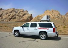
Mobile mapping system StreetMapper has achieved accuracies of better than 1cm on a Californian test area specifically designed to evaluate mobile laser scanning systems. Operated by Terrametix and designed by...
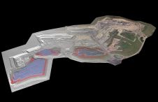
At Geo Week 2024 in Denver, Maptek unveiled its latest innovation: Maptek GeoSpatial Manager. This groundbreaking solution simplifies and streamlines workflows, revolutionizing how mining and civil engineering projects manage data...
Lidar, short for Light Detection and Ranging surveying, represents a sophisticated measuring system leveraging the power of light. Widely recognized for its versatility, Lidar is extensively applied in diverse fields...
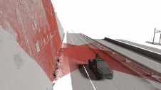
Exploring the complete potential of mobile laser scanning raises the question of whether the obtained results are sufficiently accurate for deformation monitoring. This article focuses on the geometric quality of...
Stonex has launched a new SLAM solution for fast and efficient large-area surveys: the X70GO SLAM laser scanner. It combines mobile scanning with a stationary mode to scan with higher...

Stonex is an Italian company, world leader in measurement and surveying. The head office is near Milan and the American headquarters is in Concord, USA. The company also has a...
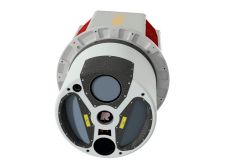
ClearSkies Geomatics, based in Colorado, USA, has recently added the RIEGL VQ-1560 II-S airborne laser scanner to its growing rental system fleet. This laser scanner, an advancement of RIEGL's dual-channel...

Global reference systems such as the International Terrestrial Reference Frame provide the foundation for determining positions on Earth and in space, as well as for reliably quantifying our planet’s changes...
This site uses cookies. By continuing to use this website, you agree to our Cookies Policy. Agree