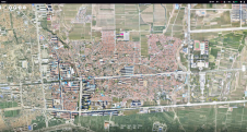
Aerial Surveying Just Got Smart
Surveyors and GIS professionals have the highest standards when it comes to their tools and trade. It is therefore no wonder that many surveyors are turning to drones for their mapping and...
Surveyors and GIS professionals have the highest standards when it comes to their tools and trade. It is therefore no wonder that many surveyors are turning to drones for their mapping and...

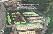
Since September, FIXAR has been equipping all its outdoor drones with the additional FIXAR BlackBox system for UAV flight data logging, enabling an increase in traceability and accountability of the...
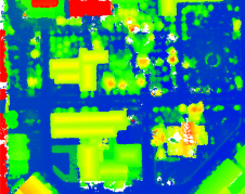
This study in Malaysia explores the use of sensor-acquired 3D point clouds as the basis for high-quality visualizations for the smart city subsurface. 3D city models are used as the...

After a slow, decades-long start, the digitization of construction has finally gained a firm foothold. While it is true that digital models are often used – and sometimes required –...
DJI recently introduced the P4 multispectral, a high-precision unmanned aerial vehicle (UAV or ‘drone’) which exploits the integration of multispectral cameras to facilitate agricultural and environmental monitoring applications. Therefore, imagery...
As the FIG commission chairs near the halfway point in their terms, they reflect on the global and technological drivers influencing their work. This article describes the breadth of work...

HERE Technologies, a leading location data and technology platform, has released high-fidelity, 3D models of 75 city centres around the world to give software developers the geospatial data needed to...

The beta version of ArcGIS Field Maps, which is available now, combines the functionalities of five existing Esri mobile apps: ArcGIS Collector, ArcGIS Explorer, ArcGIS Tracker, ArcGIS Workforce and ArcGIS...

Cesium has announced that its users now have access to Cesium OSM Buildings, a global base layer of more than 350 million 3D buildings. Cesium OSM Buildings expands the suite...
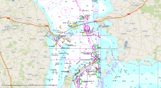
OceanWise, the leading UK-based supplier of Intelligent Marine and Coastal Mapping Data is pleased to announce the release of its Global Raster Chart dataset of the world's oceans: ‘Raster Chart...
This site uses cookies. By continuing to use this website, you agree to our Cookies Policy. Agree