Found 4744 results
Sort by

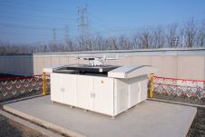
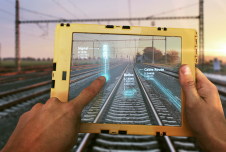
On track with a digital mindset

To maintain reliability and safety for passengers and freight, many of Europe’s rail networks are undergoing a massive digital modernization programme that includes digital twins. Backed by artificial intelligence (AI),...

Read more

Mapping altitudes in the Alpine region

Gravitational acceleration measurements were conducted in the Allgäu region of southern Germany by the Federal Agency for Cartography and Geodesy (BKG) in September this year. In high-altitude locations, helicopters were...

Read more

Redefining reality capture with BLK2GO PULSE

Leica Geosystems, part of Hexagon, has officially announced the Leica BLK2GO PULSE. This innovative first-person laser scanner merges state-of-the-art Lidar sensor technology with the iconic Leica BLK2GO design, representing a...

Read more