Sven Cowan
Sven Cowan is NV5 Geospatial’s Programme Manager for Canada. He has over 20 years of experience in customer-facing positions within the geospatial information industry and has worked for multiple geospatial...

Sven Cowan is NV5 Geospatial’s Programme Manager for Canada. He has over 20 years of experience in customer-facing positions within the geospatial information industry and has worked for multiple geospatial...
A geographic information system (GIS) has been used in the construction of a large-scale model of a smart city project in France. The smart city concept is developing very quickly...

Intergeo 2016 is almost getting started, this year being held in the vibrant German port city of Hamburg. An excellent location, especially given the fact that this year’s edition of...

Public involvement is transforming the digital city into the smart city of the future. With the EU “Smarticipate” project, the Fraunhofer Institute for Visual Computing IGD is centring its presentations...
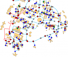
By taking Smart City as a key topic, Intergeo 2016 is focussing on a multi-faceted issue that will shape the future. The preview of the leading international event for the...

Ordnance Survey (OS) is to create a smart city standards-based technologies business framework for the European Union’s ESPRESSO project. ESPRESSO is being led by the Open Geospatial Consortium, and OS...
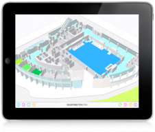
SmarterBetterCities has announced the public release of CloudCities: an intuitive 3D city service with features for community engagement, easy city data sharing and analytics. Stakeholders can easily explore new city...
At Geo Week 2024 in Denver, Maptek unveiled its latest innovation: Maptek GeoSpatial Manager. This groundbreaking solution simplifies and streamlines workflows, revolutionizing how mining and civil engineering projects manage data...
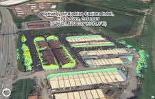
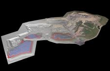
This study in Malaysia explores the use of sensor-acquired 3D point clouds as the basis for high-quality visualizations for the smart city subsurface. 3D city models are used as the...

The AlphaUni 20 (AU20) Lidar system represents a new era in cost-effective, multi-platform mobile mapping solutions, according to CHC Navigation (CHCNav), a global leader in precision mapping, positioning and navigation...
This site uses cookies. By continuing to use this website, you agree to our Cookies Policy. Agree