The good, the bad and the ugly of the surveying profession
In the early days of surveying, surveyors were pioneers in charting the unknown. Today, with the Earth having been completely mapped to some degree, surveying has become a much more...
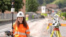
In the early days of surveying, surveyors were pioneers in charting the unknown. Today, with the Earth having been completely mapped to some degree, surveying has become a much more...
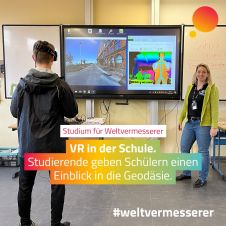
The German Association for Geodesy (DVW) has launched a campaign to build young people’s awareness of the exciting career opportunities in the geospatial industry. The world of geoinformation is diverse,...
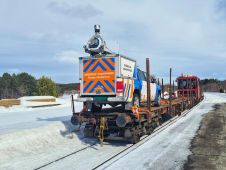
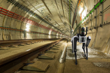
Field Group has successfully scanned all non-electrified railways in Norway using its state-of-the-art mobile mapping system (MMS). The system combines Lidar, GNSS, IMU and a 360º camera to ensure that...
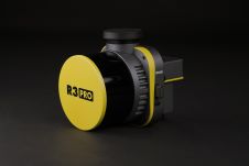
ROCK Robotic has announced the launch of its latest Lidar mapping system, the R3 and R3 PRO. The R3 product line introduces advanced hardware components into a lightweight, integrated 3D...
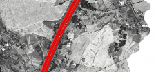
Thanks to rapid improvements in aerial laser scanning systems, they offer great potential in road surveying compared with traditional photogrammetry-based methods. Using the high-density 3D point clouds resulting from aerial...
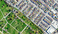
Population growth, urbanization and rapid digitalization all represent global challenges, but they also offer opportunities for the geospatial industry, because reality capture technology is an essential part of the puzzle...
To find out more about the geomatics education situation across the globe, 'GIM International' spoke to several industry experts from academia around the world. Are the numbers of students in...
Special cameras and sensors allow surveyors to acquire images and other geospatial information about the Earth and the environment. Special cameras and sensors allow surveyors to acquire images and other geospatial information about the Earth and the environment. While both image-based solutions and laser-scanning methods are evolving rapidly, there...
What are the primary technical differences between crewed and uncrewed aerial vehicles and satellites when it comes to capturing images of Earth? Where do they overlap, and where do they...

We asked James Kavanagh, head of land & resources with The Royal Institution of Chartered Surveyors (RICS), about the challenges facing the geospatial industry, the technological developments that will drive...
This site uses cookies. By continuing to use this website, you agree to our Cookies Policy. Agree