Found 4232 results
Sort by

Trimble launches MX90 mobile mapping solution

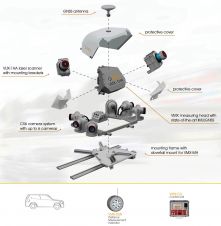
Trimble has recently unveiled the Trimble MX90 mobile mapping system. Integrating advanced Trimble GNSS and inertial technology with Trimble field and office software, the MX90 offers a comprehensive field-to-finish mobile...

Read more

IGS Workshop Celebrates 20 Years of Service

The IAG’s International GNSS (Global Navigation Satellite System) Service (IGS) held its biennial workshop from 23-27 June 2014 at the California Institute of Technology in Pasadena, California, USA. The workshop...

Read more

20 Years of ARIDA with ISPRS

ARIDA (Association for Real-time Imaging and Dynamic Analysis) is a Japanese non-governmental organisation devoted to the development of the advancement of image sensing and its applications. The association's scientific interests...

Read more

EGNOS Open Service Definition 2.0 Released

The European Commission has released version 2.0 of the EGNOS Open Service Definition Document (SDD). The revised document reflects recent improvements in EGNOS geographic coverage and other enhancements. The update...

Read more

20 GNSS Instruments for Seismic Surveying Company

Altus Positioning Systems has delivered 20 APS-3U GNSS surveying instruments to TerraView Surveys, a Canadian seismic surveying company based in Calgary, Alberta. Altus’s Canadian dealer, Butler Survey Supplies, was responsible...

Read more

Mobile Laser Scanning Point Clouds

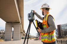
The demand for 3D maps of cities and road networks is steadily increasing and mobile mapping systems are often the preferred acquisition method for capturing such scenes. Manual processing of...

Read more