Cartomorphosis: an evolution that starts with cadastre
Over the past 15 years, geospatial information has enabled the transformation of towns, cities and a whole state in Mexico. The customer and data provider teamed up to create up-to-date...
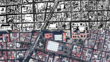
Over the past 15 years, geospatial information has enabled the transformation of towns, cities and a whole state in Mexico. The customer and data provider teamed up to create up-to-date...
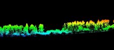
Topodrone has announced the integration of its Lidar Prime scanner with the aOrion Heli-E UAV enabled by Velodyne’s Alpha Prime sensor. This is aimed at bridging the gap in UAV-based...

Orbit GT has been updated and now supports all types of UAV imagery in its desktop products and SaaS product 3dmapping.cloud. “It’s great to announce that our latest releases support...

SI Imaging Services (SIIS) has expanded its array through a new partnership agreement with satellite imaging platform company SkyFi which gives SkyFi access to SIIS’s VHR Korean Multi-Purpose Satellite (KOMPSAT)...
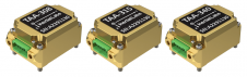
Inertial Labs has unveiled its latest innovation: high-precision three-axis accelerometers (TAA). These compact, self-contained devices mark a significant leap forward in navigation-grade accelerometers, promising unmatched precision in measuring linear accelerations....
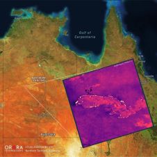
UP42 and OroraTech have signed a partnership agreement to grant easy and fast access to global high-resolution thermal-infrared imagery. UP42 is a geospatial developer platform and marketplace, and OroraTech is...
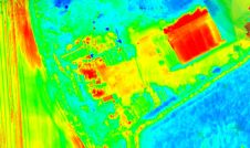
Topodrone has recently unveiled a cutting-edge drone thermal mapping solution: the Topodrone PT61 camera, designed to conduct detailed surveys and generate thermal orthomosaic maps, facilitating the creation of accurate 3D...

Blue Marble Geographic’s flagship software, Global Mapper Pro, is an all-in-one GIS package for analysing and processing vector, terrain, image and point cloud data. Compatible with over 380 different file...
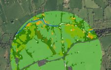
The UK’s Peak District National Park Authority is pioneering the use of artificial intelligence (AI) to automate the production of highly detailed land cover maps, in a project in partnership...
This site uses cookies. By continuing to use this website, you agree to our Cookies Policy. Agree