Elevating High-precision UAV-Lidar Mapping
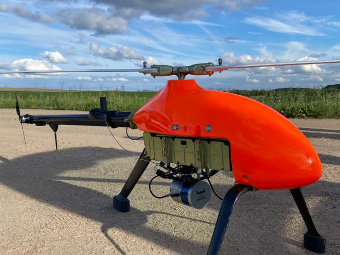
Topodrone has announced the integration of its Lidar Prime scanner with the aOrion Heli-E UAV enabled by Velodyne’s Alpha Prime sensor. This is aimed at bridging the gap in UAV-based mapping solutions between heavyweight and expensive manned aerial Lidar systems and lightweight drone Lidar systems. The system allows users to expand their applications to survey large areas that were previously only possible to survey using manned aeroplanes or helicopters. Topodrone is a Swiss-based designer and manufacturer of high-precision Lidar equipment for installation on unmanned aerial vehicles (UAVs or ‘drones’), terrain vehicles and backpacks.
The Lidar Prime plus aOrion Heli-E system is enabled by the Alpha Prime sensor, Velodyne’s world-class, long-range Lidar sensor. Velodyne’s Lidar combined together with the survey-grade GNSS receiver and high-grade inertial measurement unit (IMU) provides Topodrone with the necessary quality, working range and capabilities for mapping solutions. The system gives users the opportunity to capture dozens of kilometres of power lines and dozens or even hundreds of square kilometres of a surveying area when a manual inspection, piloted helicopter or a multicopter would create too much risk, be too costly or be incapable of tackling the challenge.
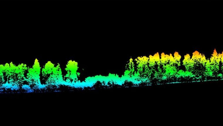
Lidar Prime is a Topodrone Lidar system with a working range of up to 300m covering a 500m corridor width and more than 20km2 per flight with the aOrion helicopter. Thanks to the aOrion’s ability to carry up to a 5kg payload for more than 1.5 hours, a surveyor can capture high-precision Lidar point clouds and orthophotos of long-line powerlines, roads and huge forest areas. At the same time, a wide range of cruising speeds (from 7-20m/s) and flexibility to choose different flight altitudes (from several metres to hundreds of metres above the ground) allow the use of all range of high-precision Topodrone Lidar systems together with a 61Mp camera. This supports the acquisition of detailed datasets for 3D monitoring, cadastral works, new construction design, forest monitoring and exploration.
Performing the Flight and Processing the Data
The Lidar Prime plus aOrion Heli-E solution is easy to operate. Before the flight, the surveyor simply needs to charge batteries for the helicopter in a special charger station, prepare a linear or area survey mission taking into account terrain level, and run the flight in automatic mode. The Topodrone Lidar system’s synchronized 61Mp camera, which is installed onboard the helicopter, captures point clouds and photos for future data processing.
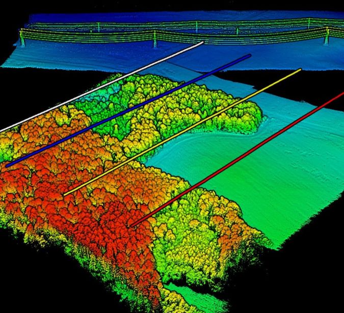
After the flight, the surveyor downloads all the datasets and as the first step runs Topodrone post-processing software to obtain the precise trajectory of the flight and to generate Lidar point clouds in a matter of minutes. The software not only facilitates the initial steps of data processing, but also strip alignment and Lidar calibration. As a result, users will receive ready-to-use georeferenced Lidar point clouds in automatic mode for future analysis, terrain extraction, contour-line generation and CAD-layers extraction.
Lidar systems offer numerous advantages, such as possibilities to work in the evening without sunlight or even at night and to capture the terrain under deep vegetation, in combination with long flight times. As a result, Lidar systems substantially expand survey companies’ capabilities, saving many labour hours and expenses. This enables them to compete with large airborne-based Lidar systems which can cost up to a hundred times more than electric-powered helicopters with small, modern Topodrone Lidar equipment on board.

Value staying current with geomatics?
Stay on the map with our expertly curated newsletters.
We provide educational insights, industry updates, and inspiring stories to help you learn, grow, and reach your full potential in your field. Don't miss out - subscribe today and ensure you're always informed, educated, and inspired.
Choose your newsletter(s)


