
EAASI Ascends to New Heights
Aerial Mapping Organizations Gain Visibility Together
More than 40 companies have joined EAASI since the European aerial mapping industry created the not-for-profit umbrella organization aimed at fostering joint interests less than two years ago. In this interview, the president and secretary-general of EAASI share their views on the association’s role in promoting and simplifying the distribution and use of aerial survey data.
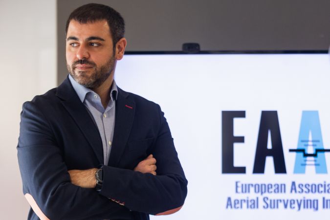
The European Association of Aerial Surveying Industries (EAASI) was founded in spring 2019. Since then, the association has attracted numerous companies and independent consultants based on the European continent that are involved in the generation of geodata from manned airborne platforms. Less than a year after the launch, it became evident that a secretary-general was needed to manage both day-to-day and strategic business operations, and Marcos Martinez was appointed in that role last autumn. Such a successful start makes him confident of the value that the organization can add: “In less than two years, 41 companies have already joined the association as members or observers. They include the most relevant European companies, international manufacturers and national mapping agencies. Between them, they operate more than 80 aeroplanes and helicopters that are fully dedicated to the acquisition of geospatial data. We’ve joined forces to create a more efficient, profitable and sustainable industry, plus our position enables us to serve as a reference point for users of European aerial survey data.”
Quality seal
On the European continent, the sector is currently confronted with a patchwork of national standards, rules and regulations. To change that, EAASI has highlighted three top priorities: 1) pan-European datasets, 2) certification/standardization, and 3) improved airspace access for aerial surveying operations.
Simon Musaeus, president of EAASI, feels an especially strong commitment to certification and standardization: “In every country, we find that users want to ascertain that geospatial data products have been acquired and created under the quality procedures appropriate to their future use. Therefore, we are currently working on a certification process which will allow our members to display the EAASI Quality Seal. We intend to offer this certification as a self-imposed framework for all association members. It will make all service providers comparable in terms of quality. That empowers the users and clients to select the right partner. Certification goes hand in hand with standardization. Common and homogeneous standards in the industry will reduce interoperability issues for everybody.”
Pan-European Lidar-based 3D data model
Ease of use is also the goal behind EAASI’s efforts to support the creation of pan-European datasets. Needless to say, this requires intense collaboration with other associations, European institutions and national mapping agencies. The target is to give users access to homogeneous cross-border geoinformation based on imagery, Lidar or the most recent hybrid Lidar/photogrammetry technologies. “From wide-area, Lidar-based height models to high-resolution 3D models of urban spaces – the added value of such constantly updated datasets would be enormous,” comments Martinez. In terms of the benefits of their continent-wide approach, they point to the USA’s Lidar-based ‘3D Elevation Program’ (3DEP): “Although it’s a North-American example so not 100% comparable, it showcases the value that can be generated for public authorities, industry and society at large. The United States Geological Survey’s most conservative calculations for 3DEP indicate a return on investment of 5:1 and the potential to generate billions of dollars in benefits. The beneficiaries are numerous, such as risk management, infrastructure, agriculture, transport and land navigation – and especially autonomous cargo traffic.”

However, defining common specifications and similar standards and securing the necessary investments cannot be done overnight. Therefore, as a first step, an internal action group is now preparing the association’s vision of the journey towards a pan-European Lidar-based 3D model. “Our key premise is that such a high-resolution, high-accuracy model must be treated as a continental need. INSPIRE (the EU infrastructure for spatial data which has been under development since 2007, Ed.) is a political commitment to European integration, formulated in the language of geoinformation. Lidar-based Europe-wide 3D datasets would give all users the actionable spatial intelligence for solving burning societal problems across the continent,” states Musaeus.
Airspace permits
The third focus area for EAASI is airspace access. European airspace is among the busiest in the world, which is why Eurocontrol is making significant efforts to improve the air-traffic management systems. New regulations are constantly being imposed on the aviation industry. Another major challenge is that different national air-traffic control (ATC) organizations have different permit procedures for aerial surveys. The secretary-general explains why this topic is high on EAASI’s agenda: “We want to build awareness among the ATC organizations about the importance of giving priority airspace access to aerial survey missions since they provide vital data collection services for governmental agencies. The air-traffic controllers should receive clear guidance about priorities to help them choose between giving access to paradropping and paragliding or aerial survey activities. This problem is not affecting other civil aviation industries such as cargo or transport, since they use other layers in the sky, so we have to work extra hard to get these procedures harmonized between all European countries. We have already started to support members of the different air-traffic management organizations in their education activities.”
Aerial survey and satellite
When asked whether the satellite and aerial survey industries are converging, the EAASI president has no hesitation in replying: “In our opinion, they are not really competing. They now complement each other better than they used to. The spaceborne remote-sensing industry has improved both the frequency (‘revisits’) of the data capture and the spatial resolution. In parallel, the aerial survey industry keeps providing much higher spatial accuracies in three dimensions on its products. The ability to capture multiple data types simultaneously – such as nadir imagery, obliques and Lidar – combined with higher mobility keeps the aerial surveyors more flexible to quickly adapt to weather and user needs. Every year, hundreds of thousands of square kilometres are photographed or Lidar-scanned in Europe using aerial survey technologies.”
Martinez continues: “We invite the spaceborne remote sensing industry to engage in constructive dialogue to further understand and complement each other and draw on the strengths of both areas. New digitalization trends and developing consumer needs are demanding bigger volumes of data and for this data to be more detailed and frequently updated. Nowadays, the market is fortunate to have so many sources of large amounts of spatial data at its fingertips, from both space and air. The use of airborne-acquired geospatial data in combination with satellite imagery allows users to improve the resolution, accuracy, cost, frequency and details of their research or projects. This opens up an incredible number of monitoring and analysis opportunities with high impact on today’s most relevant fields of action, i.e. emergency response, climate change, transport, infrastructure and sustainability.”
Technical challenges
As one of the key players in the Earth observation ecosystem, the aerial survey industry is intensely interested in research on topics such as hybrid data, artificial intelligence-based feature extraction and multiplatform data integration. Other subjects high on the agenda are 5G technology, carbon footprint reduction and the development of lightweight sensors. Acquiring the latest technology requires companies to make sizable investments. EAASI has decided not to organize dedicated working groups on technology, however, and Musaeus explains why: “There are others better equipped and focused on R&D. We have good connections with EuroSDR and all the larger manufacturers of airborne survey hardware and software, and we exchange views regularly. Our part in this information value chain is to organize the sharing of knowledge and experience in various ways, with an emphasis on forums for discussion.”
One current initiative is the implementation of an ‘Ideas Forum’, according to Martinez: “It will be the place to share the vision of our aerial survey industry and where companies, universities or users from across the industry can work closely to frame medium-term and long-term industry challenges. It will contribute to defining the basis for innovative, effective solutions that will guide the industry in the ever-evolving challenges we are facing nowadays.”
About EAASI
Dr Simon Musaeus, president of EAASI, is vice-president business development of geospatial content solutions for Hexagon’s Geosystems Division. Before Hexagon incorporated the aerial mapping business of COWI in 2020, he was COWI’s senior vice president & mapping director.
Marcos Martinez MSc, secretary-general of EAASI, has a long track record in the aerial survey industry having worked at various companies since 2006. He is experienced in leading large aerial survey and cartography projects in Europe, Latin America, Middle East, India and Africa.

Value staying current with geomatics?
Stay on the map with our expertly curated newsletters.
We provide educational insights, industry updates, and inspiring stories to help you learn, grow, and reach your full potential in your field. Don't miss out - subscribe today and ensure you're always informed, educated, and inspired.
Choose your newsletter(s)


