From paper to pixels in Benin
Benin’s journey to a nationwide digital land registry and cadastre
To provide all Beninese citizens the right to access land, bring economic prosperity and prevent land-related disputes, the Beninese government aims to establish a nationwide digital land administration system. With financial support from the Netherlands, the Land Administration Modernization Project (PMAF) started in the West African country in 2018. Unconventional methods have been used in implementing fit-for-purpose land administration, including marking borders using locally produced boundary stones, involving the local population in data collection activities, and registering presumed ownership. The results of the project are promising, with a significant reduction of costs per parcel combined with radical acceleration of the data collection and maintenance process.
With the introduction of the 2013 Land Administration Law and the establishment of the Beninese National Land Agency (ANDF), Benin had decided upon centralized land administration, with the objective of recording the entire national territory in one digital system. With this law, Benin has opted for a very high level of legal certainty, a Torrens-based system, with the provision of land titles that grant a practically indisputable property right to the natural person or legal entity stated on the title. This property right is guaranteed by the state and can only be lost through a expropriation procedure described in the 2013 Land Administration Law.
Except for the legal transition period of ten years, no further specific measures had been taken to ease the transition to the legally prescribed title system. The following assumptions implicitly provided the support that this approach would deliver the envisioned legal certainty to Benin:
- That the Land Administration Law compels all landowners, of their own accord, to apply for a land title within a foreseeable period
- That these title applications and resulting transactions generate a stream of revenue such that ANDF can provide its services in each municipality of Benin.

Five years after the introduction of the Land Administration Law in 2013, it appeared these implicit assumptions would not be satisfied. The legal certainty had increased, but its effect was limited since the transition to titles was progressing more slowly than expected. The procedure for obtaining a land title takes too long and is too complex and too expensive for most people in Benin. In 2018, approximately 45,000 land titles had been issued. By January 2021, this number had risen to about 60,000. This is only a very small part of the total number of parcels to be registered in Benin, which ANDF estimates at about eight million. In 2018, it was already obvious that this process would not succeed in registering land rights for a substantial portion of the Benin territory by the end of the transition period in 2023. This was the reason for ANDF to join forces with experts from the Netherlands in 2018 and jointly find a way to implement nationwide land administration.
Fit-for-purpose land administration customized for Benin
A customized fit-for-purpose land administration approach parallel to the existing system formed the basis for the project execution. Key to speeding up the land administration process was not to establish ownership as absolute right, but to use other verification methods and establish presumed ownership during the period of data collection. Conversion into a higher level of legal certainty, the land title, can be achieved in a later stage, for example, through the application of statutes of limitations. In contrast to the property right documented by a title, this presumed ownership is not absolute and can be disputed; it is applicable until a legal procedure decides otherwise. The introduction of the possibility for later correction provides space for a faster, cheaper and less formal approach that better aligns with the political goal of achieving a land registration system that covers the entire country in a relatively short period of time.
Unconventional implementation methods
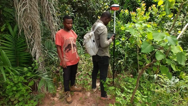
Together with the implementing partners – MDF Training & Consultancy, the Association of Netherlands Municipalities (VNG) and Kadaster International – ANDF is using unconventional methods to implement fit-for-purpose land administration. For example, in order to collect the spatial data and the administrative data in 12 municipalities subject to the PMAF project, alternative data collection approaches were deployed. Before the registration process in a specific village or region started, landowners were asked to mark their parcel boundaries using boundary stones. Preferably this was done in cooperation with the neighbouring landowner. These stones were provided by the PMAF project and made by local craftsmen. Boundary stones were needed to easily measure and map parcels in Benin as satellite imagery did not always provide information due to the limited natural boundaries between landowners’ land.

These stones were handed out in parallel with other local project interventions. For example, the project team trained the local land management committees of the village or commune on the registration process and guidance for landowners on the use of the boundary stones. In this way, active participation of the local community was guaranteed. All collected parcels were put on the same map, which had to be confirmed by the local community members through public inspection.
In the case of conflicts, mediation on the presumed ownership was done by involving local land administration committees. If the mediation failed, the parcel was registered as a conflict parcel. In those few cases, formal proceedings were required outside the scope of the project according to the new Land Administration Law.
In addition, to save time and money during data collection in the field, less accurate equipment for establishing parcel boundaries was used. During testing, it became clear that a measurement accuracy of one metre for all cadastral parcels – both rural and urban – would be sufficient to establish a first reliable and valuable land administration system. This saved costs by enabling budget GNSS receivers to be used, and provided possibilities to train more people in a limited time as data and measuring tools were easier to operate. As an added advantage, landowners better understood the tools that were used, which boosted their commitment. This data collection approach resulted in a more realistic and cost-effective operation to deliver a land administration system that covers the whole of Benin. The project mapped and registered more than 450,000 parcels in the space of three years.

Fully digital
For the collection of administrative data, a local software developer developed an open-source Android application called the ‘socio-app’. A low-cost commercial Android geodata collection app (Locus GIS) was used for on-site capture and verification of the parcel perimeter. This so-called ‘topo app’ processed the coordinates of the measured boundary points (such as the placed boundary stones) provided by the budget GNSS receiver. In addition, a consolidation application for the integration of the data from both the socio and the topo application was developed. This integration was done on the basis of assigning temporary (project) parcel numbers, with team members exchanging them so that they could each enter the same number for the same parcel in their application.
To store the data from the 450,000 parcels collected initially – and the approximately 7.5 million parcels collected in the future – an IT system called ‘e-Foncier Benin’ was created by a team of local software developers. After the field data has been processed in the digital land information system, the temporary project number is replaced by a final unique identifying parcel number, with the original project number remaining available for reference purposes. An important design feature of e-Foncier Benin is that it can visualize the legal status of parcels with a land title and also parcels with presumed ownership in such way that the legal status of the parcel is clear. The development of the e-Foncier Benin national digital land information system is based on the Land Administration Domain Model and is compliant with the ISO 19152 standard.

Sustainable maintenance
Establishing a land administration system is not limited to the collection and safe storage of data. Maintenance procedures are also necessary to keep the data up to date and reliable. A number of major financiers have already expressed their willingness to contribute towards a system of nationwide coverage. In preparation for this, work is currently underway to set up procedures to guarantee sustainable maintenance. The choices made in developing the land administration system allow these procedures to be considerably simplified compared to the current situation. This is because the system can immediately perform checks that normally have to be confirmed by several parties. As a result, the turnaround time of a transaction process can be reduced from several months to just a few days. This will make updating significantly cheaper and faster. The system is also realistic to implement because it is designed to be scalable to national coverage without ANDF having to grow at the same rate.
Significant step in Benin’s development
The Land Administration Modernisation Project in Benin is a significant step towards transforming the country’s land administration system, promoting good governance and driving sustainable development. By embracing technology, streamlining processes and enhancing local participation, Benin is ready to unlock its land potential, attract investment and empower its citizens. The project’s successful implementation will serve as a model for other countries facing similar land administration challenges. As Benin marches forward on this transformative journey, it is crucial for all stakeholders, including the government, citizens and development partners, to collaborate and ensure the project’s long-term success. With a modern and efficient land administration system, Benin will be well-positioned to realize its economic and social aspirations while preserving its rich cultural heritage.
About fit-for-purpose land administration
Basic idea of the Fit-for-Purpose approach is that land administration should be designed to meet the need of affordable tenure security for all people in a relatively short time. In Benin, this means that lower accuracy was used in determining parcel boundaries and a limited set of features was used as the start of the development of the digital e-FB system. Fit-for-Purpose is an incremental approach, and becomes more and more advanced over time.
About Benin
Situated at the crossroads of two vital regional corridors – the Abidjan-Lagos and Cotonou-Niamey routes – Benin offers a lot of potential as a significant West African commercial and tourism hub. With a breathtaking 121km coastline along the Gulf of Guinea, it beckons travellers and traders alike to explore its diverse wonders. Moreover, Benin’s commitment to robust land administration is key to sustaining its economic growth and fostering a thriving business environment. The efficient management of land resources ensures smooth infrastructure development, secure property rights and equitable access to resources. As the country continues to attract investment and tourism, its dedication to sound land governance plays a pivotal role in shaping a prosperous future.


Value staying current with geomatics?
Stay on the map with our expertly curated newsletters.
We provide educational insights, industry updates, and inspiring stories to help you learn, grow, and reach your full potential in your field. Don't miss out - subscribe today and ensure you're always informed, educated, and inspired.
Choose your newsletter(s)


