The Multispectral Journey of Lidar
Adding Channels to Laser Scanners Will Disrupt Lidar-based Target Identification
Optech Titan-3 has ushered in the era of multispectral airborne laser scanning, but multispectral terrestrial laser scanning (TLS) is still only available via research instruments, mostly for ecological vegetation studies. Analysing spectral ratios can reveal much about vegetation status and health, and multi-wavelength Lidar enables this analysis in 3D. However, multispectral Lidar will disrupt many other fields in the future. This article provides some first glimpses of how and why.
Four research groups have published 3D TLS point clouds since 2012, and many others have already focused on the multispectral laser return rather than spatial analysis. Multi-wavelength point clouds are available from groups at Boston University (the Dual-Wavelength Echidna Lidar (DWEL)), University of Salford (the Salford Advanced Laser Canopy Analyser (SALCA), the Finnish Geospatial Research Institute Hyperspectral Lidar (FGI-HSL) and the spectral Laser Detection And Ranging (LADAR) laboratory demonstrator in Maryland. All these are full-waveform digitizing scanning Lidars and provide the first insights into spatial distribution of spectral data.
There are a couple of ways to extend a conventional Lidar approach to a multi-channel one: using multiple or tunable lasers, or a supercontinuum, i.e. the so-called ‘white’ laser. Multiple or tunable lasers offer eye safety and signal to noise (S/N) ratios comparable to traditional Lidars. Supercontinuum lasers provide a continuous spectrum, but it is a challenge to achieve an eye-safe power level that gives sufficient return signals for remote measurement. This can be accounted for by restricting the wavelength range to near-infrared (NIR) or indoor operation with limited access, which then limits its usage in the urban environment, for example. The detector usually comprises a pair or an array of photodiodes and a digitizer that is fast enough to record the incoming waveforms. The multi-wavelength function poses more demands for this equipment.

Future prospects for disruptive applications
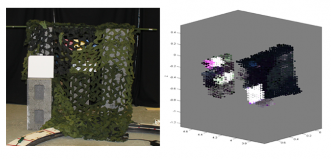
Active spectral imaging initially emerged for military purposes. Targets concealed behind camouflage nets can be detected from their spectral features. Adding spatial data enhances that as object distances and shapes can be differentiated (Figure 1). Defence and security-related imaging also calls for long-range measurement, for distances up to 1.5km, which is feasible with high-power supercontinuum lasers.
Vegetation photosynthetic capacity and health can be mapped over entire trees with multispectral point clouds, as chlorophyll can be inferred from spectral indices. This is a novelty, as high spatial resolution (leaf level) can be provided in larger scales than before, even up to stand level with TLS. Another disruptive aspect comes from the fact that destructive sampling is not needed, which enables the creation of time series. DWEL and SALCA have also been applied in the separation of leaves from bark.
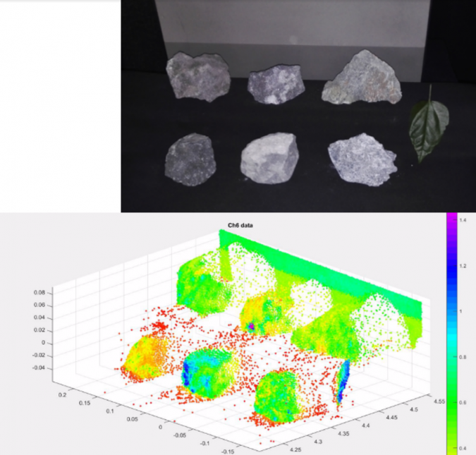
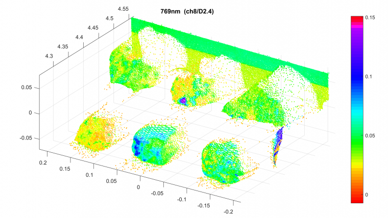
The FGI scientists have done initial tests with the HSL to explore applications other than vegetation. These include distinguishing pollution in snow, detecting obscured targets, separating artificial objects from vegetation and observing target moisture in buildings. Multispectral Lidar has the potential to replace visual identification in separating minerals from gangue (waste rock) in mines, see also Figure 2.
Challenges of multispectral Lidar
The reason that many multispectral Lidars still focus mainly on spectral data is that consistent spectral performance is challenging with laser and there are greater demands for accurate radiometric calibration than in the single wavelength case. This calls for an improved level of technological readiness. Beam alignment is an issue in multi-laser instruments, whereas supercontinuum lasers have synchronization and stability problems of their own. On top of that, conventional Lidar features such as multiple echoes (which are more difficult to interpret in the multi-wavelength case), waveform sampling and range measurement need to be optimized simultaneously and they sometimes compromise the spectral accuracy. This may be the reason for such a limited number of studies that actually present point clouds. However, as the range resolution and accuracy of multispectral Lidars is increasing with constant instrument development, topographic information is becoming more accurate. The same goes for recently published radiometric calibration efforts, which will improve the spectral resolution and the retrieval of spectral ratios and indices. This comes at the cost of computing time, however, as multi-channel point clouds are vast and slow to process.

Conclusion
Multispectral terrestrial Lidar instruments represent the next generation of terrestrial laser scanning, and they are slowly reaching technical maturity for commercial application. Further R&D will be needed for optimized operation, data processing for real-time environment perception, overcoming the eye-safety issues and fully utilizing the spatially distributed spectral data. These may never be realized with a general-purpose instrument, but the hardware could be custom-made for a specific application. Commercial availability may also be implemented as a service, with point clouds being the product, or as part of a large platform of instruments (e.g. mounted in a robot or on a vehicle) to complement the situational awareness gathered from multiple sources.
Combining with other sensors
Lidars are rarely used as stand-alone instruments. They have always been combined with positioning to produce georeferenced point clouds and they are increasingly used as a component in a multi-sensor ecosystem. Improved sensor-based situational awareness will be an essential part of Lidar usage in the future. This is necessary for autonomous vehicles, as they need to perceive the environment and cannot rely on satellite positioning only. Satellite positioning is prone to vulnerabilities and not available in all conditions. Sensor fusion is also being tested in indoor or underground conditions by combining inertial, radio frequency (such as ultrawide band) and visual sensors. This, and the emergence of hyperspectral laser scanning, will take indoor simultaneous localization and mapping (SLAM) to a totally new level, but real-time processing of vast data volumes still needs a major effort. It is fast to analyse a spectrum from one point, but utilizing the full 3D representation takes more time. Artificial intelligence is being explored as a potential approach. The hardware will also need to be cost-effective and small, which will also affect the instrument design of multispectral Lidars.

Value staying current with geomatics?
Stay on the map with our expertly curated newsletters.
We provide educational insights, industry updates, and inspiring stories to help you learn, grow, and reach your full potential in your field. Don't miss out - subscribe today and ensure you're always informed, educated, and inspired.
Choose your newsletter(s)


