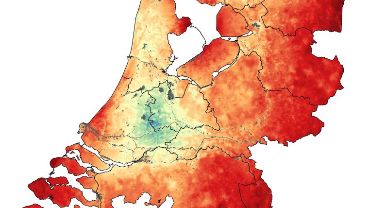
Improving Agricultural Efficiency with Satellite Data
Humans started to cultivate land around 10,000 years ago, so we must be pretty good at it by now. However, environmental concerns, sustainability, quotas, subsidies and paperwork make farming more challenging than ever. Satellites offer a solution to many of these problems, but how does the ordinary farmer tap into their potential? Satellites such as Europe’s Copernicus Sentinel missions and ESA’s SMOS and the upcoming Florescence Explorer, FLEX, provide a wealth of information about growing conditions and crop health that can be used to improve agricultural efficiency.
But satellite data are just the starting point – they have to be turned into easy-to-use applications to be of any real value to farmers. Ger Nieuwpoort, director of the Netherlands Space Office, said there is clearly huge potential for Earth observation to be exploited much more than it is today. For example, we see a gap between organisations that develop extremely sophisticated satellites and people in the field dealing with farming subsidies. Ironically, in the world of agriculture, the gap between raw data and possible end users is a largely ‘uncultivated’ area, Nieuwpoort added.
World’s second-biggest food exporter
Despite it being a small country, The Netherlands is one of the world’s largest exporters of agricultural and food products, and a country that adopts ever-increasingly sophisticated techniques to keep the business efficient and sustainable. A recent workshop at the Netherlands Space Office attracted representatives from the farming community, consultants, companies that turn data into usable products, and scientists.
Maurice Borgeaud, head of ESA’s Earth Observation Science, Applications and Climate Department, said the workshop attracted such a wide range of actors, highlighting that Earth observation data are not only used for science and to develop applications, but also for the commercial downstream market, and hence play an increasingly important role in business and the economy.
Sentinel satellites
The Sentinel missions are revolutionising the way satellite data are used for practical purposes such as farming. Not only are their observations accurate and systematic, they are free of charge – and, importantly, they will continue for years to come. Knowing that there will be this continuity is essential for business models, investments and planning for the future.
ESA’s Susanne Mecklenburg stated that Earth Explorer satellites such as SMOS and FLEX are important too because although they are essentially built for science, they demonstrate new space technologies that can be developed for more ‘operational’ purposes. With the obvious advantages that Earth observation can bring to sectors such as agriculture, there is growing number of ‘value-adding’ companies that specialise in taking satellite data and turning them into commercial products that can be used by farmers.
Soil moisture masurements
Richard de Jeu from the Dutch value-adding company VanderSat explained that soil moisture measurements, like they get from SMOS, are indispensable for assessing the availability of water. Value-adders can use these measurements to give farmers advice on irrigation, warn them of drought or water stress, and help to improve their crop yield predictions. The continued provision of these data is essential for companies and farmers alike.
Workshop co-organiser Tamme van der Wal from AeroVision stated satellites are becoming a part of an integrated monitoring system and the workshop showed that farmers, banks and administrations can all benefit.
ESA is also making considerable effort to ensure satellite data are exploited to their full potential through a range of Thematic Exploitation Platforms. Here, the idea is to make information available to the non-expert along with the tools and resources they need – and critically make all this accessible from one place.
Satellites are, without doubt, becoming more and more relevant for everyday life. And thanks to a growing sector in the world of business along with the efforts of space agencies and the EU, the space age is bringing more and more benefits to one of our oldest professions – farming.
Further reading
Geoinformation in Arable Farming: What’s Hot and What’s Not in Precision Agriculture; Tamme van der Wal and Henk Janssen, Wageningen University & Research (WUR), The Netherlands
Advancing Smart Farming Thanks to Geospatial Technologies; Wim van Wegen, GIM International
Source: ESA.

Value staying current with geomatics?
Stay on the map with our expertly curated newsletters.
We provide educational insights, industry updates, and inspiring stories to help you learn, grow, and reach your full potential in your field. Don't miss out - subscribe today and ensure you're always informed, educated, and inspired.
Choose your newsletter(s)


