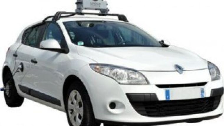
New ACTRIS Vehicle-borne Image-base Mapping System
With the strong support of SBG Systems, ACTRIS tries to revolutionise GIS data collection method by releasing VIAPIX, a vehicle-borne image-base mapping system. The company chose the IG-500E for real-time image georeferencing. This miniature inertial sensor directly merges inertial data with GPS and odometer information to achieve the best performance. VIAPIX is a vehicle-borne mapping system.
The VIAPIX systemcan be easily mounted on the roof of a car. During the ride, six cameras capture 360-degree images that are automatically and accurately georeferenced. This system carries out the field survey with unprecedented speed and improves operator security thanks to its remote process. After the field data collection, the qualification step takes place at the office. Data is imported into the VIAPIX analysis software. To qualify them, the operator navigates into a "Streetview" like window in which he can measures distance, enters codes and comments directly on images. Data is then ready to be imported into the GIS database.
Real-time image georeferencing
Connected to an odometer and to the VIAPIX internal GPS receiver, the IG-500E improves position accuracy. As it embeds an extended Kalman filter designed by SBG Systems, the inertial navigation sensor takes into account external aids and merges all these complementary information in real time. To get the best performance of every sensor, SBG Systems calibrates all components in dynamic and temperature. Roll, pitch, heading, and position are transmitted at a frequency of 100Hz to the processor of VIAPIX while captured images are directly georeferenced. The accuracy of the IG-500E time stamping was crucial at this step, said Clément Gutierrez, ACTRIS; the IG-500E is accurate to 50 nanoseconds. Other technical topics have contributed to ACTRIS choice. Based on MEMS technology, IG-500E inertial navigation system is miniature, robust, cost-effective, and low-power consumption.

Value staying current with geomatics?
Stay on the map with our expertly curated newsletters.
We provide educational insights, industry updates, and inspiring stories to help you learn, grow, and reach your full potential in your field. Don't miss out - subscribe today and ensure you're always informed, educated, and inspired.
Choose your newsletter(s)


