Survey to Create 3D Model of Schiphol Rail Tunnel
GeoNext has used Trimble technology to survey the Schiphol Tunnel and provide measurements as the basis for a 3D model to support essential railway maintenance and upgrades. Millions of passengers pass through the Schiphol Tunnel every year; it is a vital transport link between central Amsterdam and Schiphol Airport in the Netherlands. The speed and precision of the laser scanners and total stations enabled the surveying team to meet strict accuracy and delivery requirements.
The Schiphol Tunnel is part of a 17km passenger train route connecting central Amsterdam and Schiphol Airport, one of Europe’s busiest airports based on passenger volume. There is frequent rail traffic through the tunnel, and any interruption impacts passengers going to and from the airport as well as trains en route to other cities in the Netherlands, Belgium and France. Safety and reliability are major priorities of the interconnected rail network.
ProRail is the government agency responsible for maintenance and expansion of the Dutch national railway. In 2020, ProRail commissioned GeoNext, a Dutch geodetic engineering firm, to survey the Schiphol Tunnel and build a comprehensive 3D model that could be used to plan repairs and infrastructure upgrades.
A highly accurate model was required to ensure proper alignment of new tracks and adequate clearance for the fast-moving passenger trains. The strict 7mm or better accuracy requirement meant that GeoNext needed to use top-quality equipment and carefully follow workflow processes for efficient data collection.
The Challenges of a GNSS-denied Environment
Surveying the tunnel presented a combination of several unique challenges, such as the lack of GNSS underground, the 7mm accuracy requirement, and the need to work around train schedules. Fast scanning was a necessity because access to the Schiphol Tunnel was restricted to pre-scheduled maintenance days.
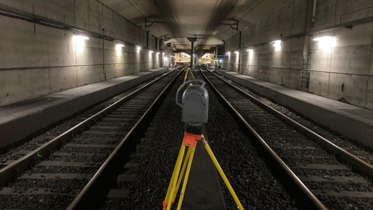
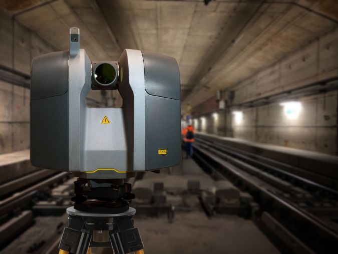
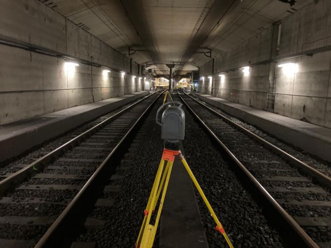
GeoNext has extensive experience with laser scanning and rail surveying and owns several Trimble TX8 scanners, Trimble S Series total stations and GNSS base and rover systems. The TX8 laser scanner is well suited for fast and accurate surveying. Its powerful laser delivers a high point density and collects one million points per second, a major advantage when faced with strict time constraints. Also, the rugged design of Trimble instruments ensures reliable operations in the challenging environment of a tunnel.
“The Trimble TX8 enables us to scan more than one track at the same time,” explained Daisy Sparla, project leader at GeoNext. “The 360-degree scanner allowed us to set up in between the tracks and collect everything in that specific area. While the scanner was completing its scan, we had time to hang the next targets. It was a highly efficient process.”
To make up for the lack of GNSS in the tunnel, GeoNext used emergency exits to set GNSS points outside with Trimble R10 and R12 GNSS receivers. They levelled to the Dutch height system NAP and connected the outdoor GNSS points to targets inside the tunnels. For measuring the coordinates of these targets inside the tunnel, GeoNext used the Trimble S7 and S9 total stations with prisms.
3D Model of Tracks and Objects
Working in close cooperation, the GeoNext team collected around 750 scans with the TX8, with a scan every 20m and overlap of 5-10m. Close scan station setup spacing and overlap between consecutive scans enabled GeoNext to reach the necessary 7mm accuracy. The team surveyed the two 6.5km dual-track tubes in just four weekends.
After scanning was complete, GeoNext utilized Trimble RealWorks to process the scan data. The auto extract feature in RealWorks is helpful for identifying targets and matching the scans. Bentley MicroStation Connect was used to build the complete 3D model of tracks and objects, and the point cloud was delivered in RD-NAP (Dutch coordinate system).
“Thanks to the combination of dedicated teamwork, detailed planning and high-tech equipment, we were able to stick to our tight schedule,” said Sparla. “We were confident that we could deliver a high-quality 3D model.”

Value staying current with geomatics?
Stay on the map with our expertly curated newsletters.
We provide educational insights, industry updates, and inspiring stories to help you learn, grow, and reach your full potential in your field. Don't miss out - subscribe today and ensure you're always informed, educated, and inspired.
Choose your newsletter(s)


