Transformative trends in laser scanning
In this Q&A, we asked Trimble’s Jeff Turgeon to share his insights into the current state of the sector and his expectations for the future. Looking at terrestrial laser scanners,...
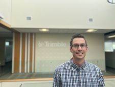
In this Q&A, we asked Trimble’s Jeff Turgeon to share his insights into the current state of the sector and his expectations for the future. Looking at terrestrial laser scanners,...
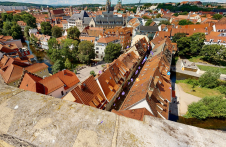
Lidar-powered Matterport technology was employed to create a 3D digital twin of the most famous inhabited bridge globally, the Krämerbrücke, situated in the city of Erfurt, Thuringia, Germany. The Krämerbrücke...
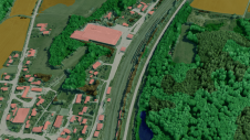
Innovative methodologies based on artificial intelligence (AI) are lowering the barriers and democratizing the use of 3D digital twins in the geospatial industry. Digital twins are revolutionizing the geospatial industry,...
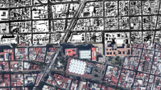
Over the past 15 years, geospatial information has enabled the transformation of towns, cities and a whole state in Mexico. The customer and data provider teamed up to create up-to-date...

Juan Partida is CFO of the government of Jalisco, having been a public servant for the last 15 years. From the outset, his involvements have included modernizing and designing cadastral...

Blue Marble Geographic’s flagship software, Global Mapper Pro, is an all-in-one GIS package for analysing and processing vector, terrain, image and point cloud data. Compatible with over 380 different file...
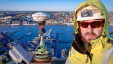
The revolutionary use of active GNSS control points and cutting-edge geomatics equipment is setting new standards for accuracy in the construction of high-rise architecture, as demonstrated by this skyscraper project...

Both vertical and oblique aerial images have their own advantages, making them valuable in different reality mapping applications. So how can you choose between the two? This comparison will help...

Recently unveiled by Vexcel Imaging, the groundbreaking UltraCam Dragon 4.1 represents one of the market's most advanced, progressively designed and seamlessly integrated hybrid aerial mapping systems. Tailored for high-resolution mapping...
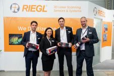
RIEGL has recently added the VUX-18024, a lightweight and versatile UAV-Lidar sensor for high-speed surveying missions, to its portfolio. This once again underlines the Austrian company’s pioneering role as a...
This site uses cookies. By continuing to use this website, you agree to our Cookies Policy. Agree