Planet
Planet was founded with the mission to image the Earth every day and make change visible, accessible, and actionable. Over the past decade with our customers, Planet has revolutionized the...

Planet was founded with the mission to image the Earth every day and make change visible, accessible, and actionable. Over the past decade with our customers, Planet has revolutionized the...

A man who received a 360-degree camera as a gift has taken it upon himself to incorporate his neighbourhood in Guernsey into the Google Street View online map, according to...
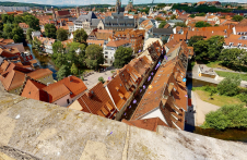
Lidar-powered Matterport technology was employed to create a 3D digital twin of the most famous inhabited bridge globally, the Krämerbrücke, situated in the city of Erfurt, Thuringia, Germany. The Krämerbrücke...
Innovative methodologies based on artificial intelligence (AI) are lowering the barriers and democratizing the use of 3D digital twins in the geospatial industry. Digital twins are revolutionizing the geospatial industry,...

The Open Geospatial Consortium (OGC) membership seeks to form a new Land Administration Domain Model (LADM) Standards Working Group (SWG). Public comment is sought on its draft Charter. Comments are...
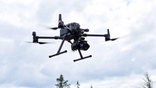
Cyberhawk has entered into a global partner agreement with Phase One. Together, they will deliver the utmost standard of industrial inspections to the most discerning customers, leveraging the advanced capabilities...
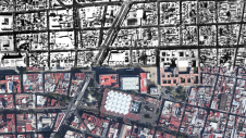
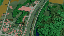
Over the past 15 years, geospatial information has enabled the transformation of towns, cities and a whole state in Mexico. The customer and data provider teamed up to create up-to-date...

Blue Marble Geographic’s flagship software, Global Mapper Pro, is an all-in-one GIS package for analysing and processing vector, terrain, image and point cloud data. Compatible with over 380 different file...
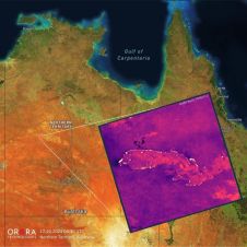
UP42 and OroraTech have signed a partnership agreement to grant easy and fast access to global high-resolution thermal-infrared imagery. UP42 is a geospatial developer platform and marketplace, and OroraTech is...

Both vertical and oblique aerial images have their own advantages, making them valuable in different reality mapping applications. So how can you choose between the two? This comparison will help...
This site uses cookies. By continuing to use this website, you agree to our Cookies Policy. Agree