European Space Loses Leading Figure
It is with great regret that ESA has announced the death of Michel Bignier, which occurred on 12 October. A leading figure in the space world, and a former director...
It is with great regret that ESA has announced the death of Michel Bignier, which occurred on 12 October. A leading figure in the space world, and a former director...
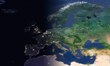
EuroGeographics is drawing attention to the indispensable role of official national geospatial data in enhancing Copernicus Services, particularly within land monitoring and emergency management. This highlights a reinforced partnership between...
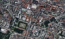
Vexcel Imaging, a leading provider of aerial camera systems, mobile mapping platforms and fully integrated photogrammetry software, is launching one of Europe’s highest-quality and most up-to-date aerial image libraries. Starting...
European Space Imaging has been awarded a fourth multi-year agricultural framework contract to deliver an estimated 1.2 million square kilometres of very high resolution (VHR) satellite imagery and associated services...

A topobathymetric Lidar survey was conducted to support flood preparedness in Canada. Which techniques achieved exceptional precision, and what were the logistical challenges? Find out more in this article. As...

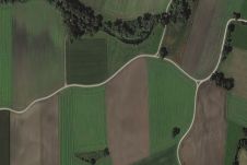
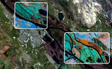
Recently unveiled by Vexcel Imaging, the groundbreaking UltraCam Dragon 4.1 represents one of the market's most advanced, progressively designed and seamlessly integrated hybrid aerial mapping systems. Tailored for high-resolution mapping...
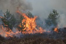
The number of wildfires has increased dramatically in recent years due to diminishing forest health caused by the drastically changing climate across the world. Longer dry-weather periods and pressure from a variety of pests and diseases, e.g. bark beetles, are affecting the large forest areas in Northern Europe. In addition to financial losses, these impacts are resulting in lower carbon accumulation and vast ecological changes. The number of wildfires has increased dramatically in recent years due to diminishing forest health caused by the drastically changing climate across the world. Longer dry-weather periods and pressure from...

The organisation of the fourth edition of European Space Solutions are inviting geospatial professionals for registration. Hosted by the 2016 Dutch Presidency of the EU Council, the conference brings business and policy...
SimActive, the Canadian developer of photogrammetry software, has entered into an agreement with Space Imaging Middle East (SIME), whereby SIME will act as an authorised SimActive distributor in the Middle...
European Space Imaging (EUSI) has recently have announced a strategic partnership giving users direct access to the world's most detailed hyperspectral imagery from Pixxel. Combined with EUSI’s capability to build...
This site uses cookies. By continuing to use this website, you agree to our Cookies Policy. Agree