Exploring the State of Mobile Mapping
What is the current state of acceptance of mobile mapping, and what are its most common applications? A worldwide survey commissioned by NavVis, and supported by 'GIM International' plus three other...
What is the current state of acceptance of mobile mapping, and what are its most common applications? A worldwide survey commissioned by NavVis, and supported by 'GIM International' plus three other...
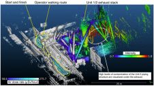
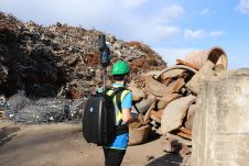
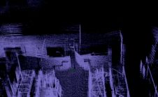
The Japan Atomic Energy Agency (JAEA) successfully developed a way to 3D scan and visualize the radiation data from the 2011 Fukushima nuclear disaster by combining a Compton camera, radiation...

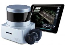
Kaarta, the innovator of real-time mobile 3D reality capture, has announced Kaarta Cloud, a new solution to process, store and share 3D spaces. It provides a fast, convenient and flexible...
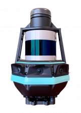
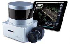
Kaarta, a specialist in real-time mobile 3D reality capture, is introducing Stencil Pro, a professional-grade mobile mapping platform with high-quality dimensional and visual fidelity. The multipurpose Stencil Pro mobile mapping...
Velodyne Lidar recently announced that Kaarta has included Velodyne’s smart, powerful Lidar technology in Kaarta’s new Stencil 2-32 ground surface mapping solution. Equipped with Velodyne Lidar, Stencil 2-32 accurately scans...
Kaarta, the innovator of real-time mobile 3D reality capture, has announced that it has raised US$6.5 million to accelerate the growth of its mobile mapping and localization technology. Kaarta’s technology...
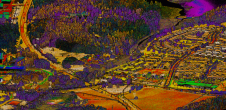
Which technologies and processes are building the capability for high-density 3D data? Point clouds can be captured by an ever-increasing number of means to understand the surrounding reality and detect critical...
Kaarta has announced a new version of its Stencil real-time 3D scanning system with better hardware, improved accuracy, and an easier workflow. It has double the onboard storage capacity for...

Kaarta has made another leap forward in the advance of rapid 3D reality capture with the launch of Kaarta Reality Layer. This augments its already geometrically accurate and robust spatial...

Mobile scanning can be an equally accurate yet more cost-effective solution than traditional terrestrial laser scanning done with tripods. To succeed, however, mobile scanners not only require a suitable combination...
This site uses cookies. By continuing to use this website, you agree to our Cookies Policy. Agree