What is Geomatics?
As the only educational institution offering a BSc (Hons) course in Geomatics (Surveying and Mapping) in the whole of the Republic of Ireland, the Dublin Institute of Technology (DIT) has...

As the only educational institution offering a BSc (Hons) course in Geomatics (Surveying and Mapping) in the whole of the Republic of Ireland, the Dublin Institute of Technology (DIT) has...

Robotic theodolites, the new generation of the well-known surveying theodolite, are used to measure deflections in short-span bridges with millimetre accuracy. This permits the coming true of an old dream...

Amberg Technologies AG has been developing user-friendly system solutions for georeferenced data acquisition and processing in the field of infrastructure development for around thirty years. This Swiss company offers standardised...
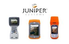
GPS is good for perhaps 70% of surveying needs. Inertial Navigation is the forgotten friend of GPS. Traditionally complex and expensive, Inertial Navigation has become competitive, easy-to-use and cost-effective. Need...
Everyone who truly matters in the geomatics and surveying-related business will be travelling to Germany ¨C or more precisely to the Bavarian city of Nuremberg ¨C in the last week...

The VI International Conference 'Remote Sensing - the Synergy of High Technologies 2012' is to be held from 25th to 27th April 2012 in the ATLAS PARK-HOTEL near Moscow, Russia....
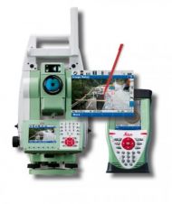
Leica Geosystems has announced its new robotic Imaging Total Station, the Leica Viva TS15. This total station provides advanced imaging functionality combined with dynamic tracking capabilities for one-person surveying. Furthermore,...

Leica Geosystems‘ version 4.1 of MobileMatriX fully integrates the new Viva Total Stations and many other improvements. With the imaging support of the new TS15 and TS11, Leica MobileMatriX users...
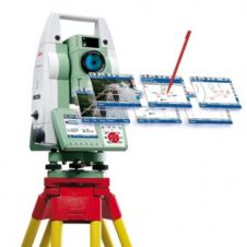
Leica Geosystems has announced its new Manual Total Station, the Leica Viva TS11. This modern total station provides imaging functionality and features the Leica SmartWorx Viva onboard software. ...

Version 3.50 of the Leica SmartWorx Viva onboard software is now available, supporting both Leica Viva GNSS and Viva TPS instruments, and controlling the newly released Leica Viva TS12 Total...
This site uses cookies. By continuing to use this website, you agree to our Cookies Policy. Agree