Please Look Down!
The US space agency NASA has successfully pushed the asteroid Dimorphos out of its original orbit in the universe, according to a recent announcement. The space rock was hit 11...

The US space agency NASA has successfully pushed the asteroid Dimorphos out of its original orbit in the universe, according to a recent announcement. The space rock was hit 11...
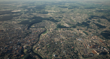
A national mapping agency in Europe needed to create a 3D digital twin of its entire country from a collection of geospatial data in varying scales and formats. A primary...
In which direction is the geospatial industry heading? Which core activities will companies focus on? How will the rapidly progressing technological advances shape the future? The recent edition of HxGN...
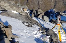
A project in Aotearoa/New Zealand is combining the use of high-quality DEMs from satellite photogrammetric mapping (SPM) with Lidar technologies to model hazards such as snow avalanches. The resulting topographic...
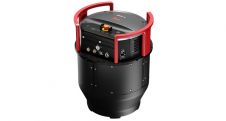
Leica Geosystems, part of Hexagon, has launched the Leica DMC-4, a highly efficient airborne imaging sensor providing unsurpassed image quality for various applications and complex mapping environments. With the new...
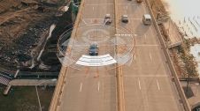
Trimble has introduced data integrity monitoring for its precise point positioning (PPP) correction service, CenterPoint RTX Fast. The Trimble RTX Integrity monitoring system is an innovative, patented solution, built in...
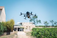
Attendees of YellowScan's recent Lidar for Drone 2022 Conference headed home with a backpack full of inspiration, according to Wim van Wegen. A relaxed vibe, sunny weather with summer temperatures,...

NavVis, the German provider of reality capture and digital factory solutions, is capturing BMW Group’s worldwide plants and making the photorealistic panoramic images, floor plans and point cloud data available...
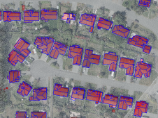
How can artificial intelligence and deep learning lead to a robust process for 3D city modelling? And what are some of the challenges? Automated classification and object detection in Lidar...
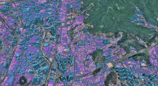
Ecopia AI is expanding its partnership with Airbus, pairing Ecopia’s large-scale 3D vector mapping technology with Airbus’ global satellite imaging capability. This partnership will enable the creation of a high-precision...
This site uses cookies. By continuing to use this website, you agree to our Cookies Policy. Agree