Have you got your free ticket to GEO Business?
GEO Business will put the spotlight on geospatial innovation for two days long, from 17-18 May. At ExCeL London, around 3,500 geospatial professionals will come together to discover and debate...

GEO Business will put the spotlight on geospatial innovation for two days long, from 17-18 May. At ExCeL London, around 3,500 geospatial professionals will come together to discover and debate...
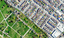
What are the primary technical differences between crewed and uncrewed aerial vehicles and satellites when it comes to capturing images of Earth? Where do they overlap, and where do they...
BAAM.Tech has reached an agreement with RIEGL USA in Winter Park, Florida, to become its North American distribution partner. Headquartered in Lenexa, Kansas, BAAM.Tech will assume sales, training and technical...
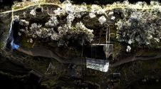
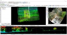
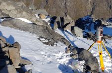
A RIEGL VZ-400i 3D terrestrial laser scanner was deployed in Peru to create a high-resolution digital 3D terrain model of an ancient fortress. This is a good example of how...
The RIEGL VQX-1 is a compact, rugged but lightweight, aerodynamically shaped wing pod ready for the user-friendly installation and straightforward application to facilitate various airborne mapping applications. The pod is...
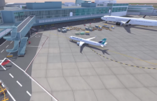
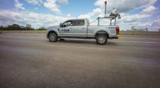
At the 2022 Technology Impact Awards in British Colombia, Vancouver International Airport (YVR) recently received the Excellence in Industry Innovation Award from the BC Tech Association. The award-winning project involved...
RIEGL’s latest generation of professional Terrestrial Laser Scanners stands for extreme versatility, high productivity, ultimate performance, and additional mobility – providing an excellent return of investment. 3D position accuracy of...
Mosaic has announced that the company’s new Mosaic X spherical camera is now compatible with RIEGL’s mobile mapping systems. RIEGL V-Line scanners are currently some of the highest performing and...
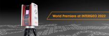
Making their European debut, LP360 and the all-new TrueView 655/660 will be exhibited at Intergeo 2022. The TrueView 655/660 is GeoCue’s third-generation RIEGL integration built with the miniVUX-3UAV and triple...
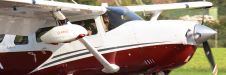
A project in Aotearoa/New Zealand is combining the use of high-quality DEMs from satellite photogrammetric mapping (SPM) with Lidar technologies to model hazards such as snow avalanches. The resulting topographic...
This site uses cookies. By continuing to use this website, you agree to our Cookies Policy. Agree